Tents and Tubs
April 4, 2019: Fresh off of a fun week with my parents exploring Albuquerque during their Spring Break in Albuquerque, we headed back to work for a few days preparing taxes for many of the fine people of the Duke City. But after playing tourist with my mom & dad and realizing our time in Albuquerque was quickly ticking away, we were ready for another adventure. After all it was only T minus 11 days until the tax deadline and we would be heading back to the East Coast in just a few short weeks.
We turned the nose of the car North and started toward one of the many National Parks Service locations we wanted to visit during our stay in New Mexico. We didn’t do as well with the list as we had hoped, but we couldn’t let that stop us from at least getting to one more. It was about an hour to Kasha-Katuwe Tent Rocks National Monument and it took us through some beautiful New Mexico countryside, including through the San Felipe, Kewa and Cochiti Pueblos which we had just learned about at the Indian Pueblo Cultural Center the week prior.
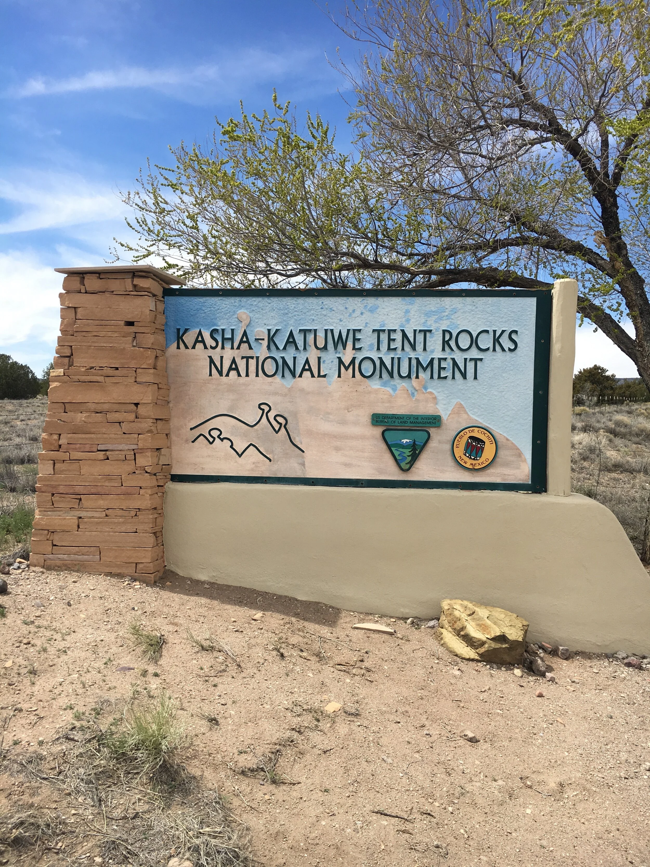
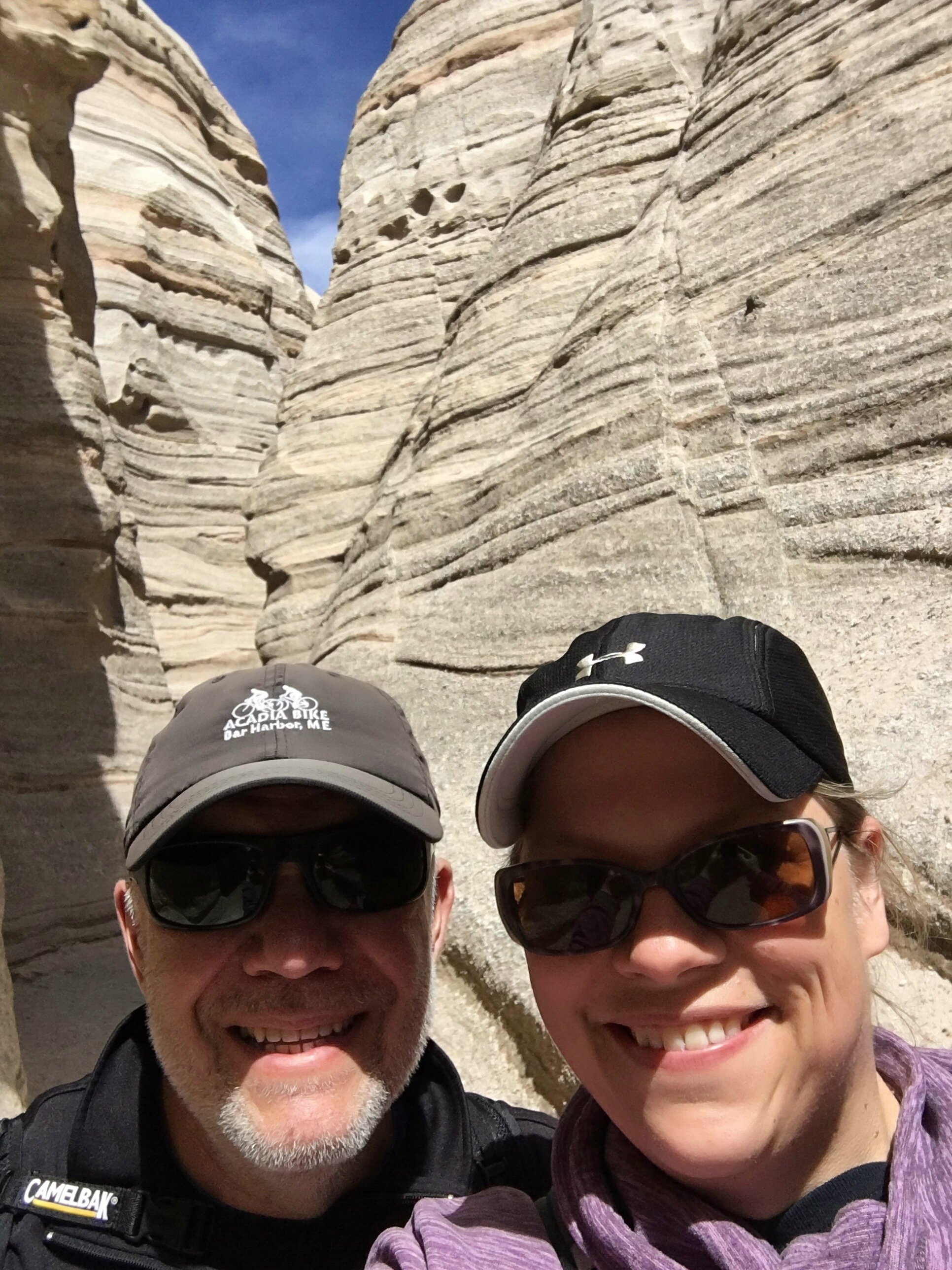
The Kasha-Katuwe National Monument is ran by the Bureau of Land Management (BLM) in conjunction with the Pueblo de Cochiti, since part of the park is located on the pueblo grounds. In the Keresan language, spoken by the native Cochiti people, Kasha-Katuwe means “white cliffs”. After flashing our fast pass, no not Disney’s version, but our National Parks Pass, we were given a map of the area, told to head about 4 miles to the parking area and sent off to explore. We arrived at the parking area located at the trailhead where there was a nice picnic area and clean bathrooms which we used before beginning our hike. There are two segments of the foot-travel only trail and we combined the two: the Cave Loop Trail is 1.2 miles and stays at the base of the rocks and the slightly more difficult Slot Canyon Trail is 1 mile out and 1 mile back and includes passing through a slot canyon, a steep, but minimal ascent and a reward of magnificent views from the mesa top over the Tent Rocks and the surrounding area.
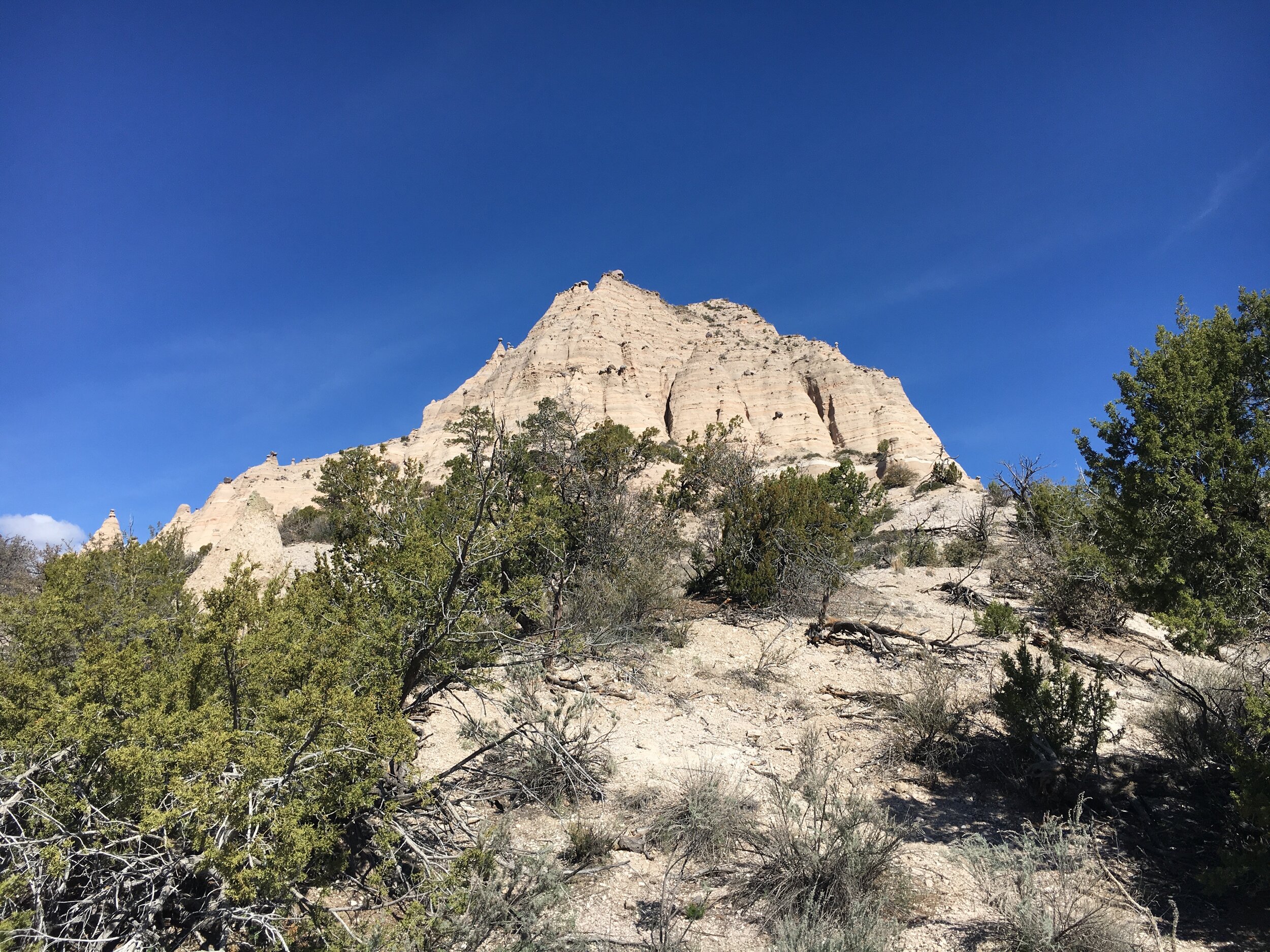
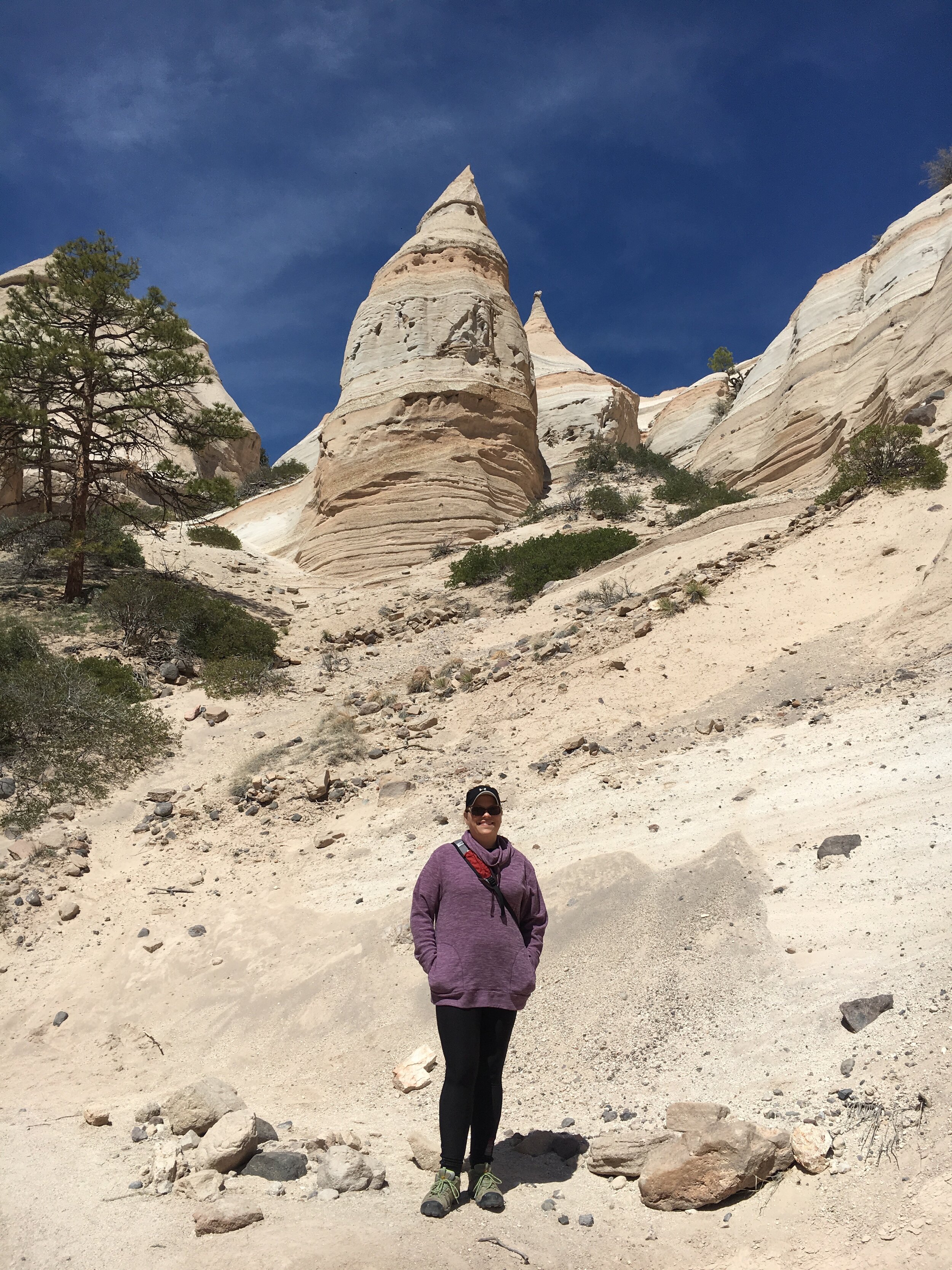
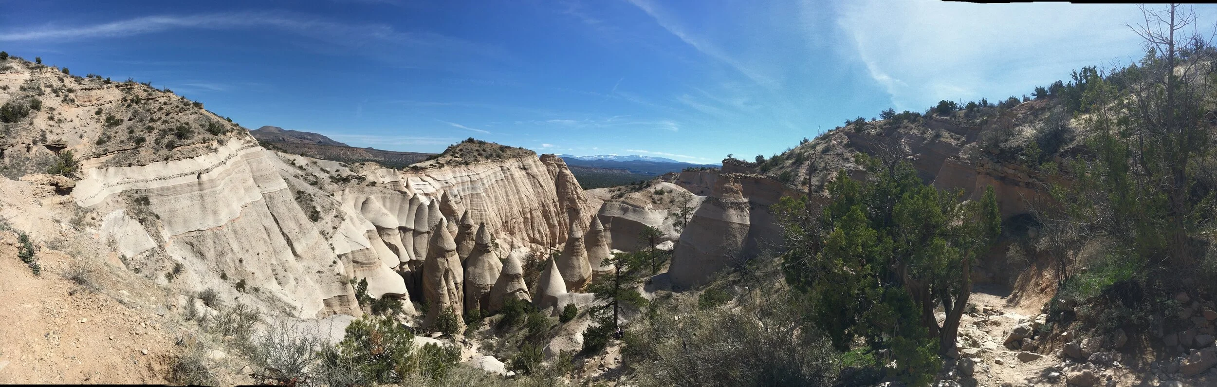
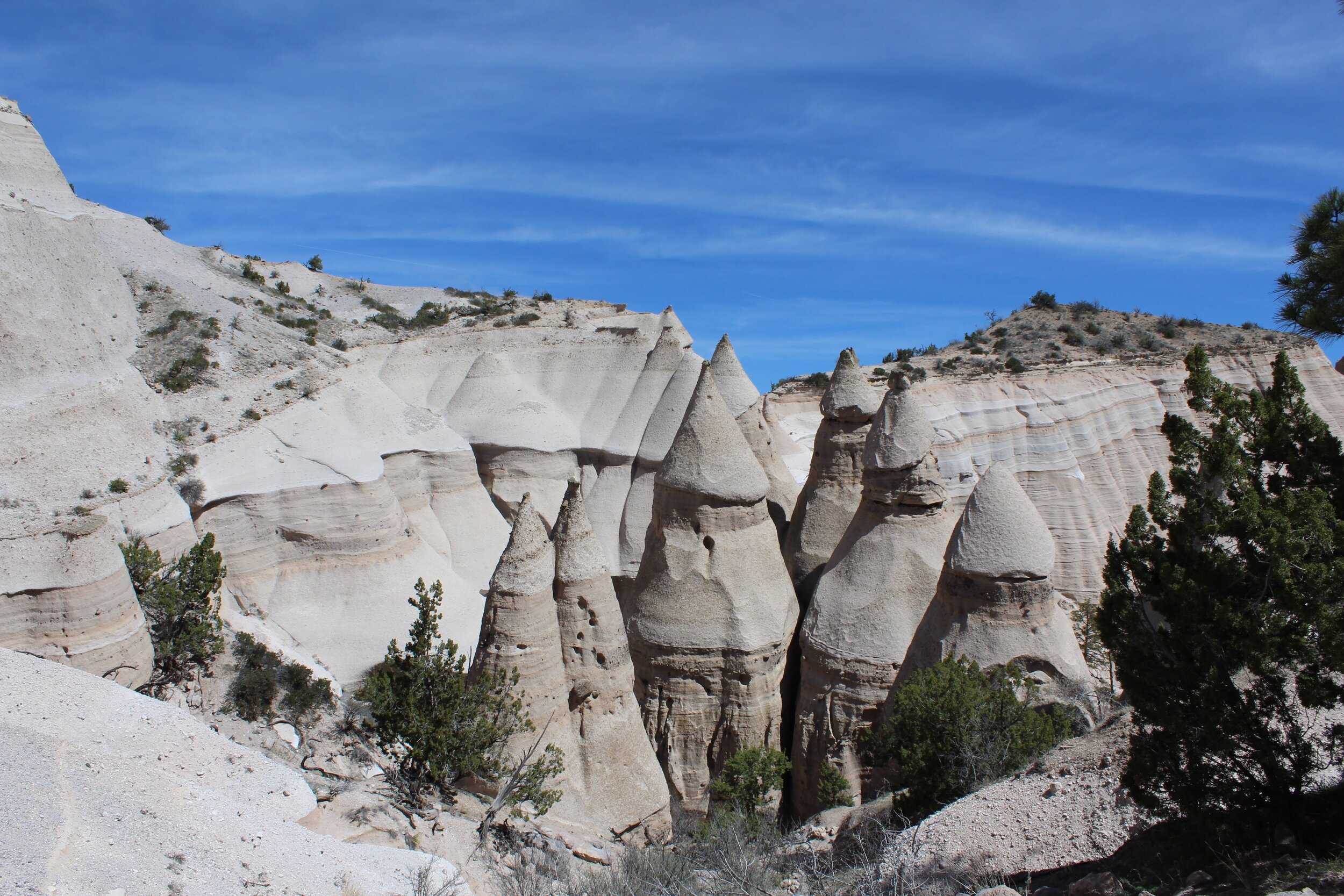
After departing from the parking lot, it only took a few steps on a handicap accessible trail to be greeted by the geologically unique group of rock formations located in the foothills of the Jemez Mountains that gave this National Parks Site its Tent Rocks name.
We stayed right when we reached the spur trail to the canyon. The trail snaked through an arroyo dotted with trees and arid landscape. If you just raised your hand to ask what an arroyo was, you likely are not from the Southwest United States. As a midwesterner and east coaster, it was a new term to us as well. An arroyo is a steep-sided gully formed by the action of fast-flowing water in an arid or semiarid region, found chiefly in the southwest. Think dried up creek bed, or a place you don’t want to be if a flash flood pops up!
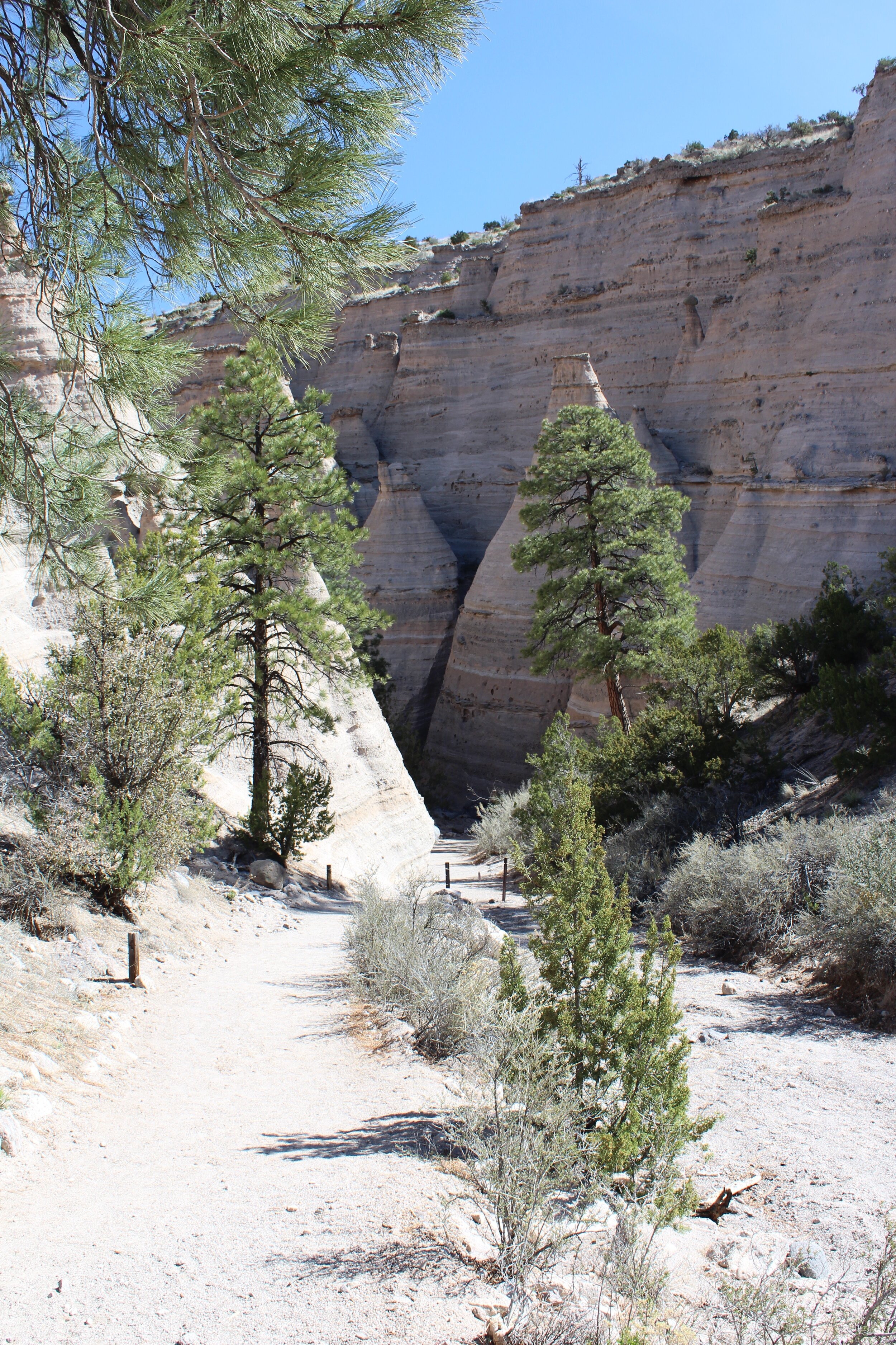
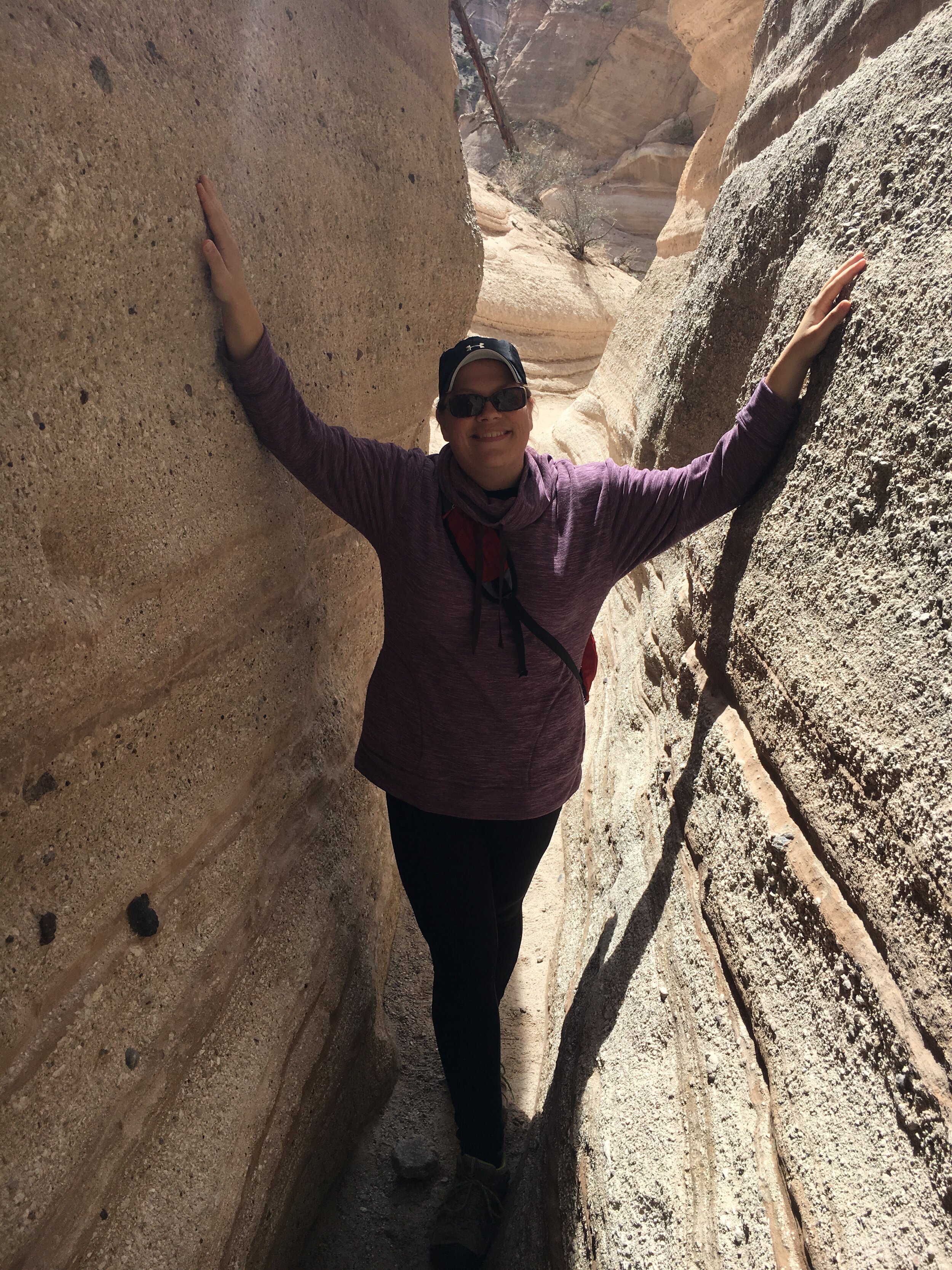
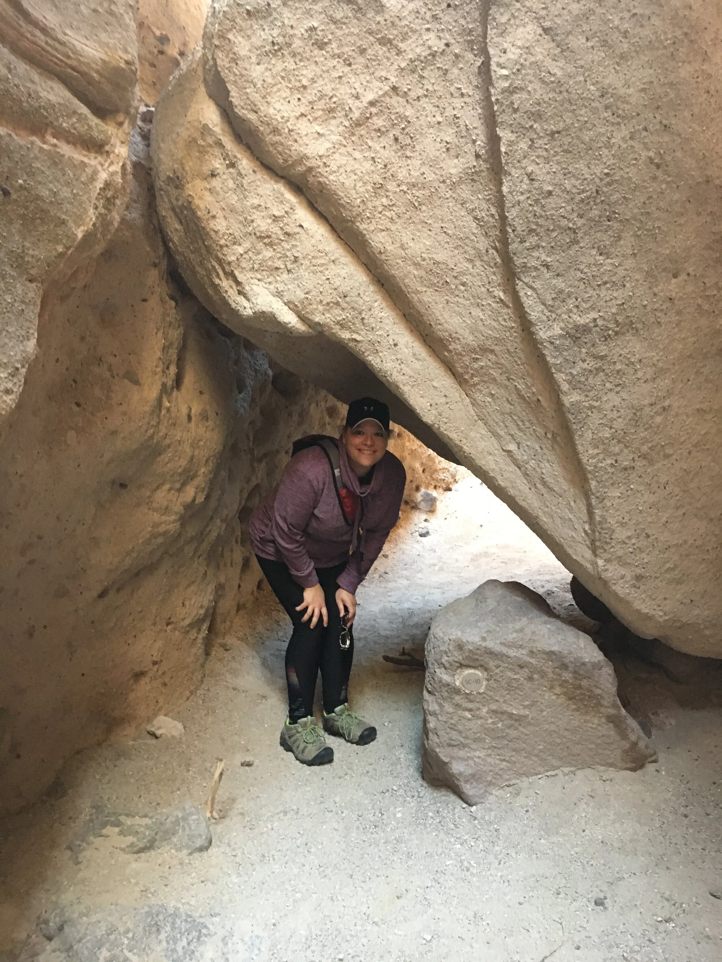
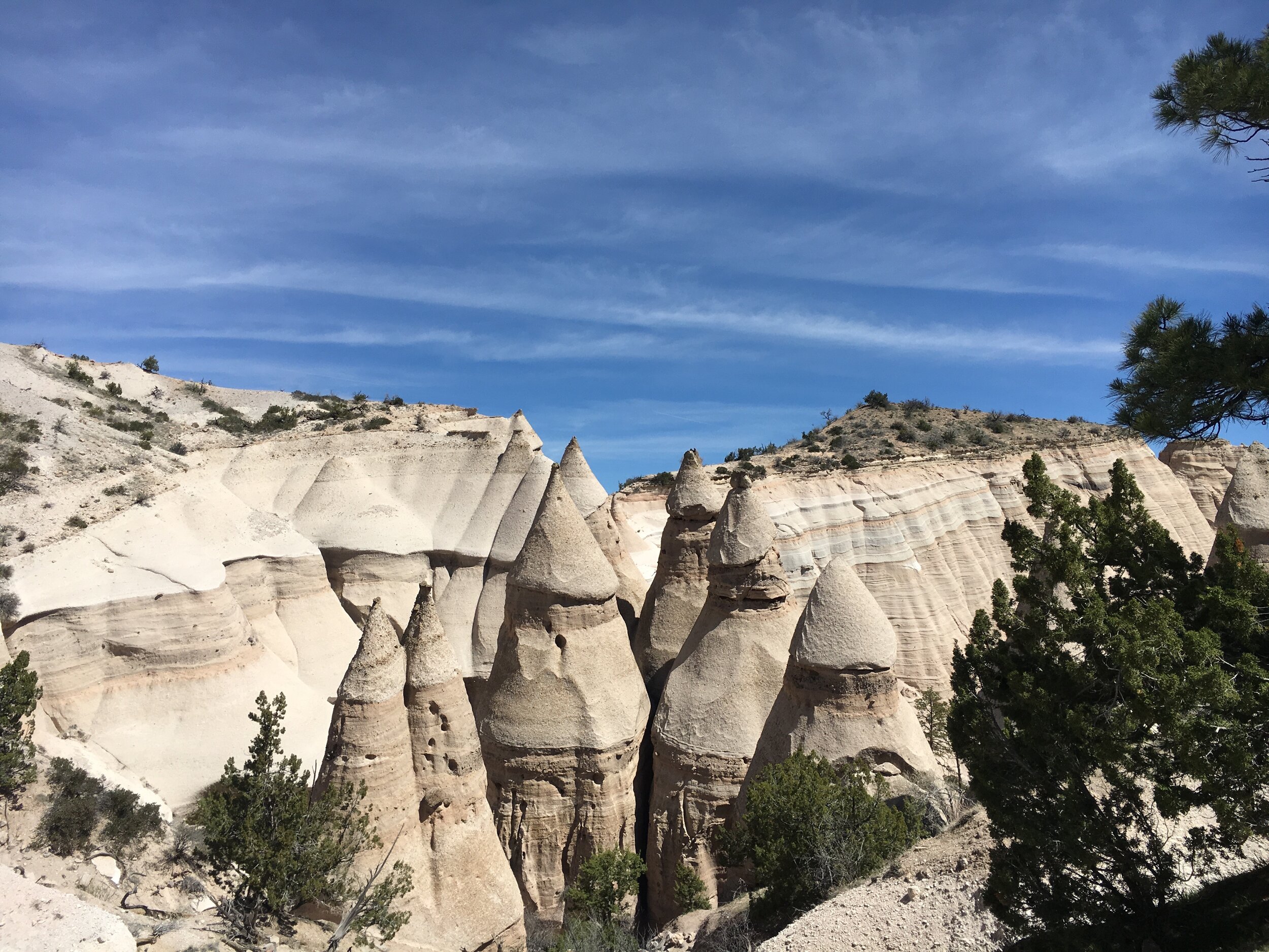
As we continued to meander, the trail narrowed and the walls grew higher. Before long, we were in a shady, narrow slot canyon with a few small rock scrambles necessary. At only about a quarter mile, the slot canyon was short-lived, but confirmed to me that I do indeed LOVE slot canyons and can’t wait until our travels bring us a chance to hike through some of the more famous ones such as Lower Antelope in Page, Arizona and Zion Narrows in Utah. I’m not sure what makes them so appealing. Maybe the fact that they were carved over millions of years with what began as a tiny crack and steadily grew from repeated flash floods and erosion creating these narrow, twisty-turny canyons with very high, beautifully designed scalloped walls. Pure beauty without any human engineering.
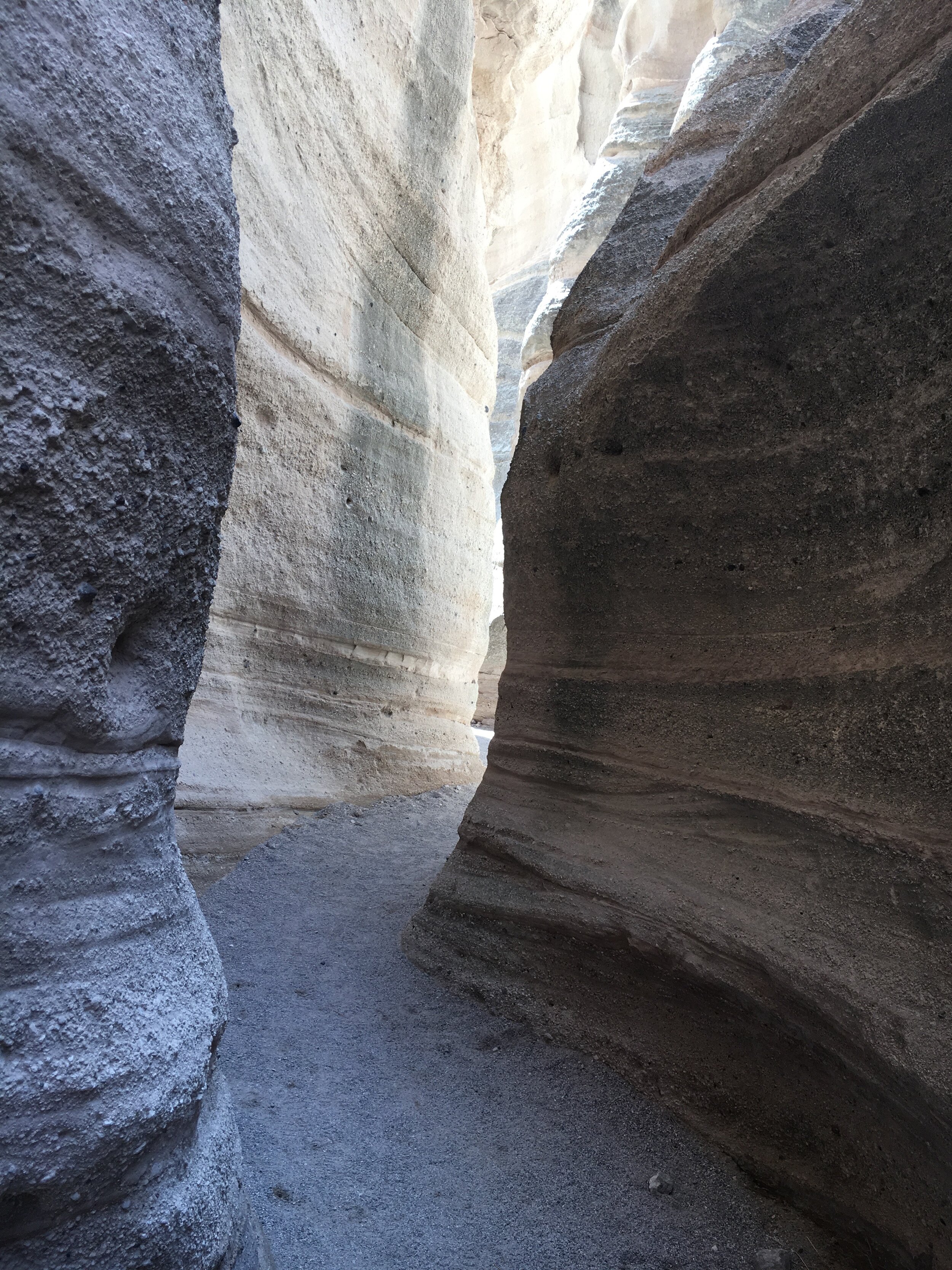
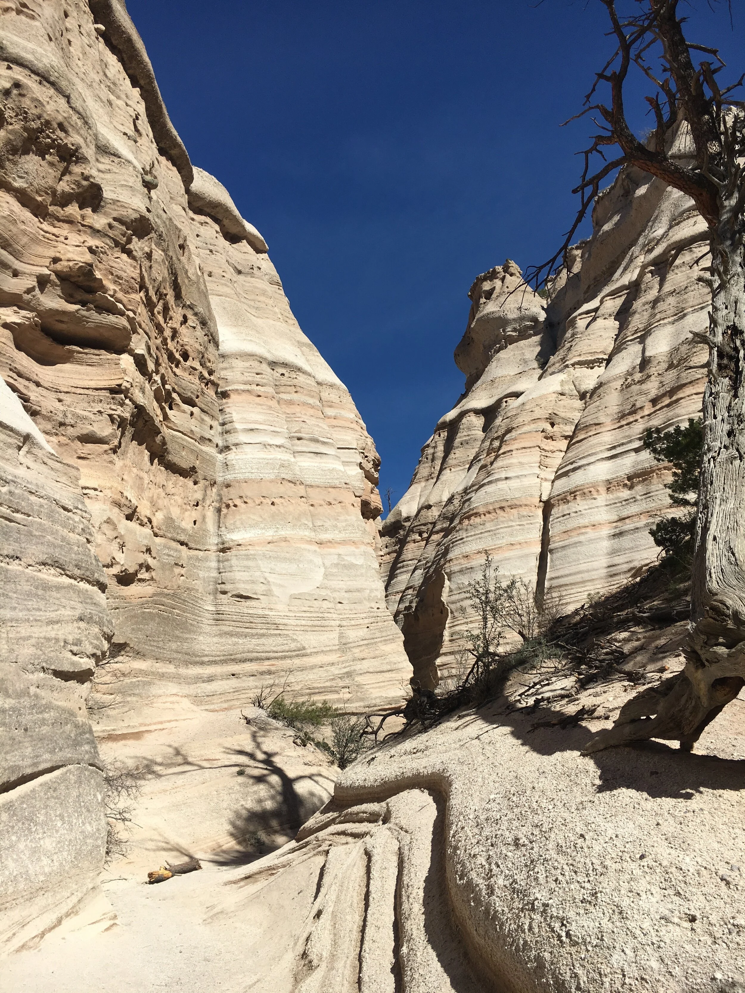
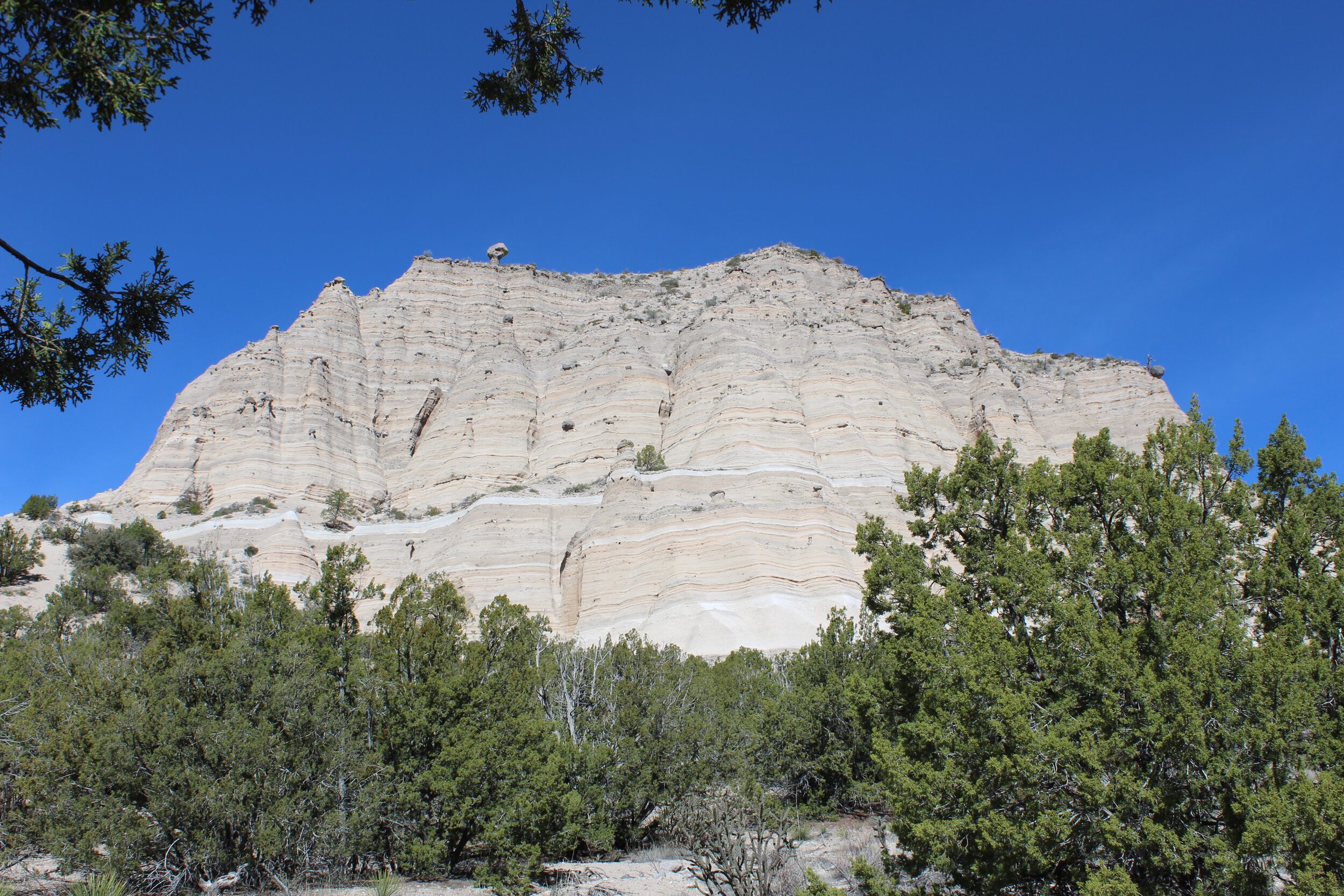
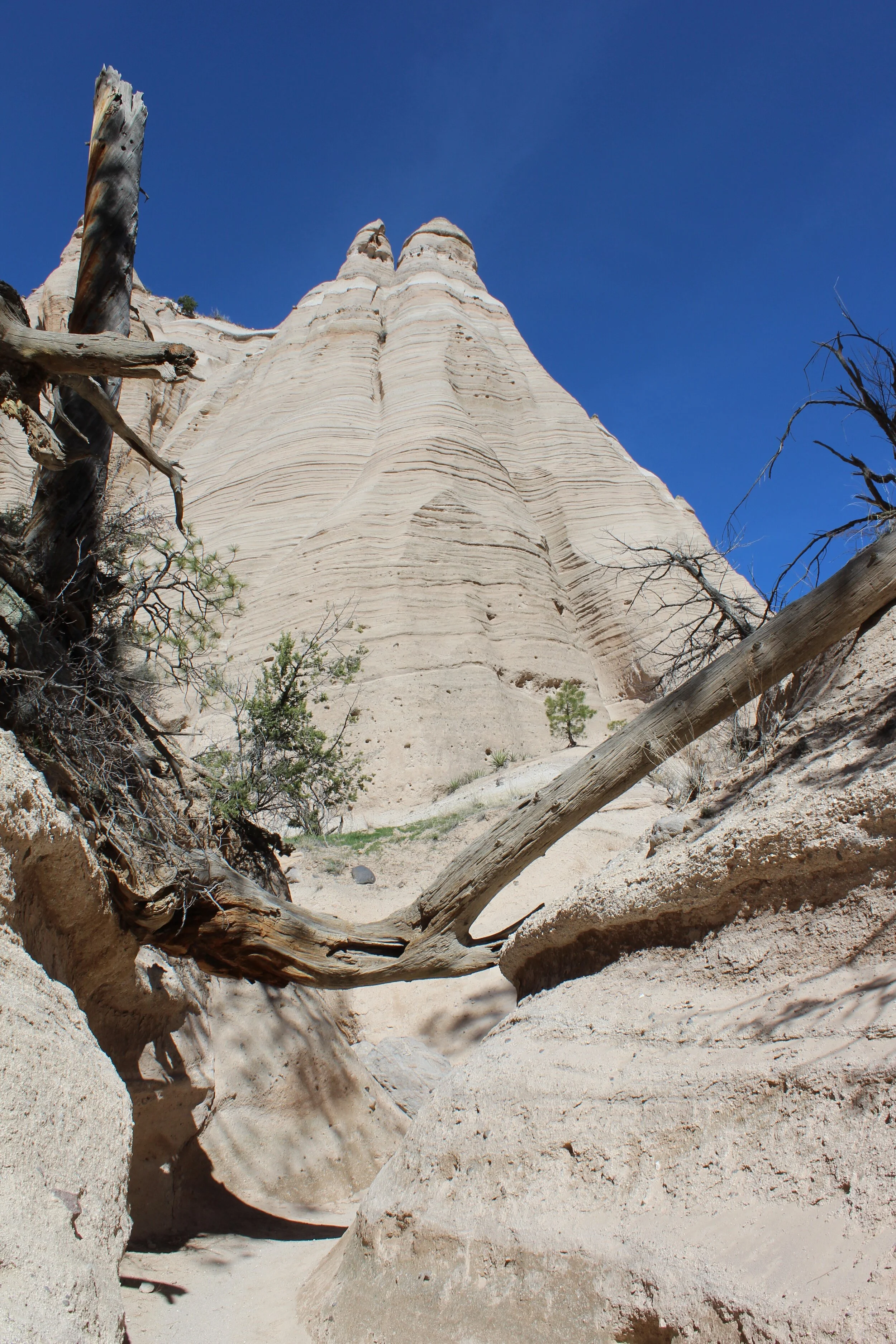
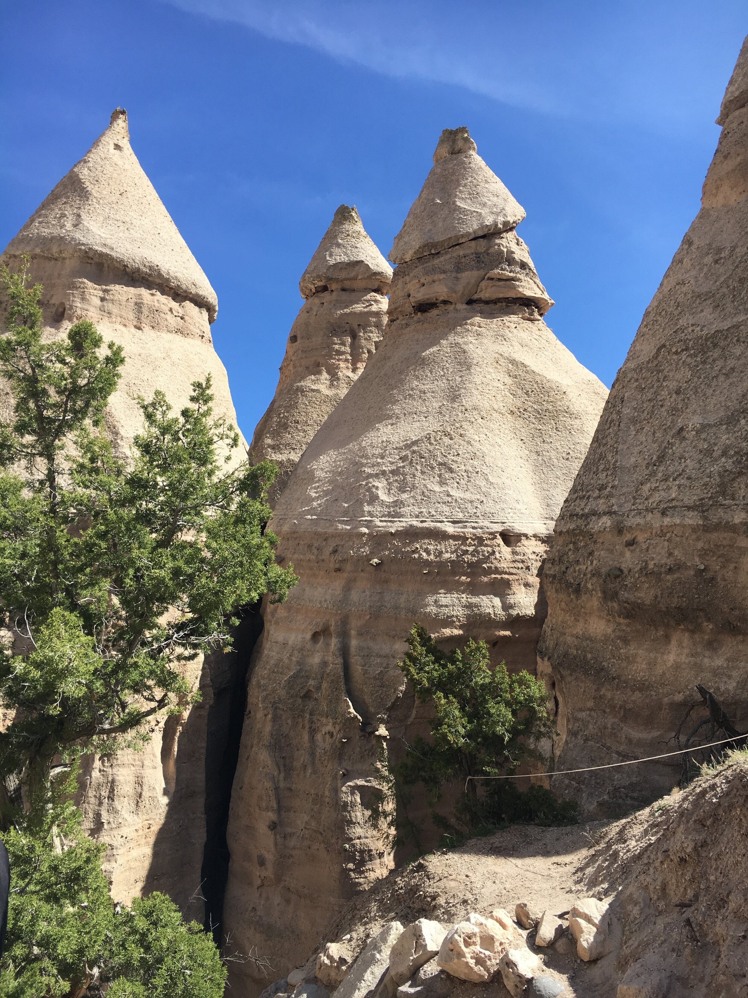
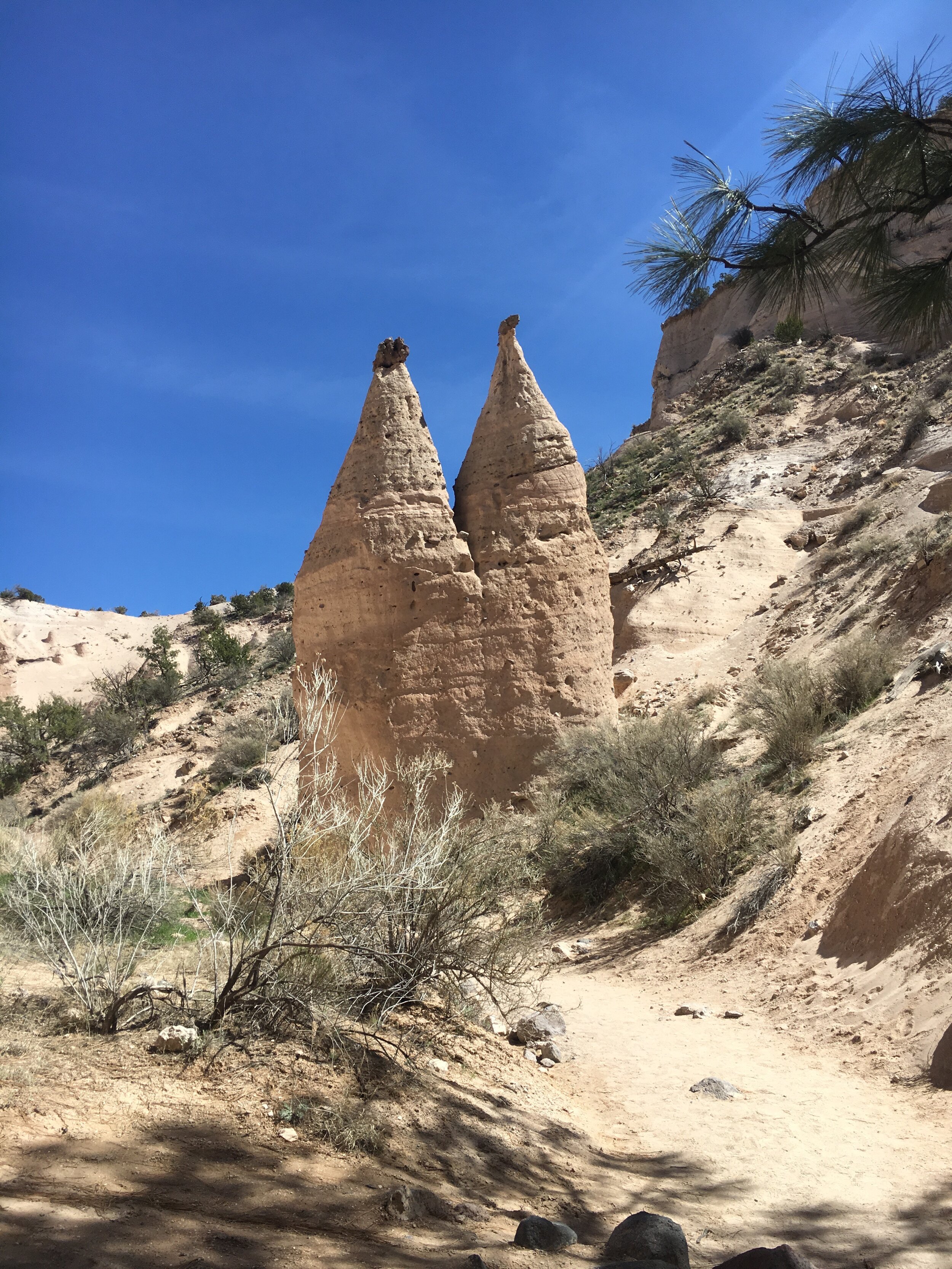
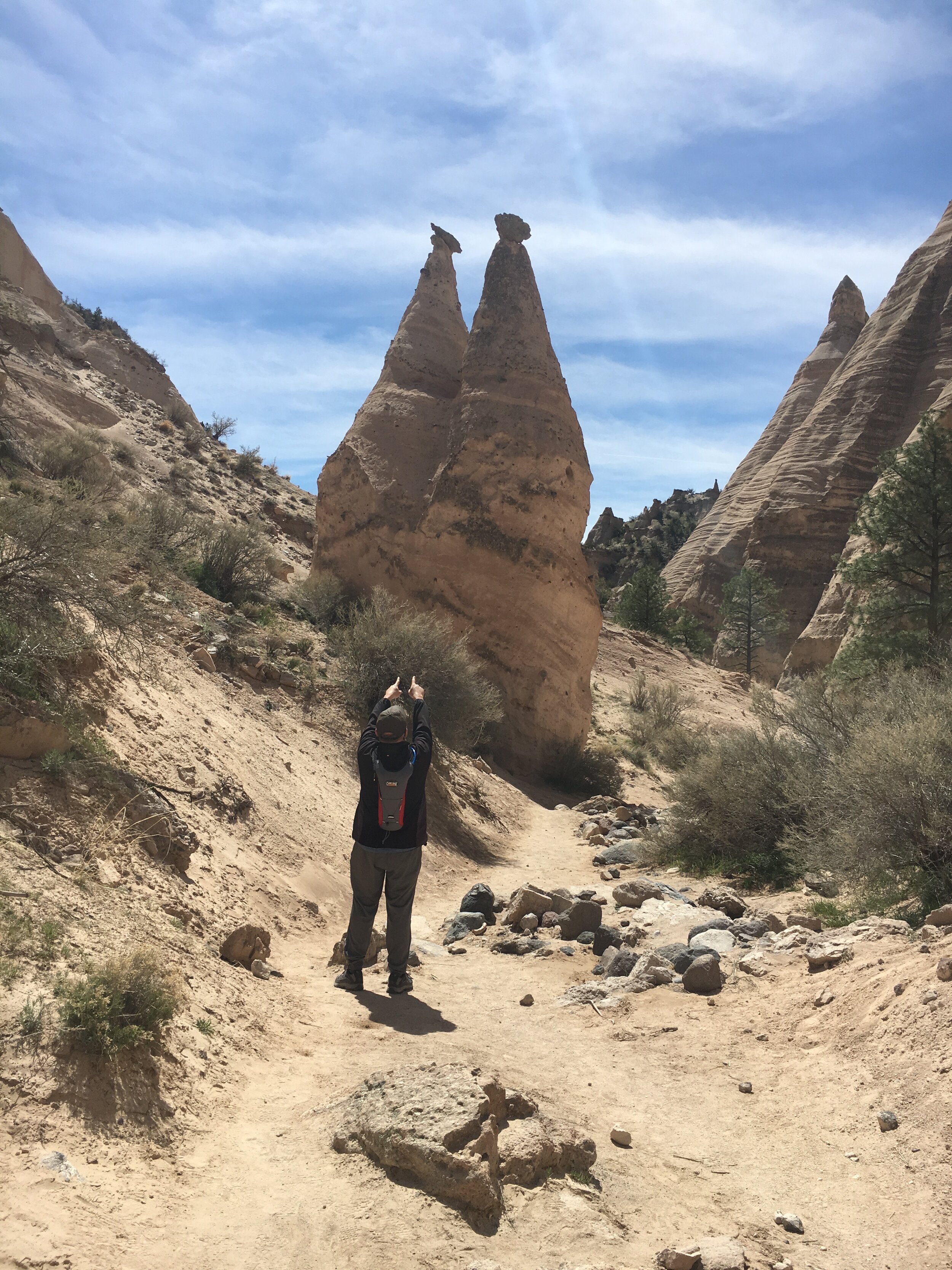
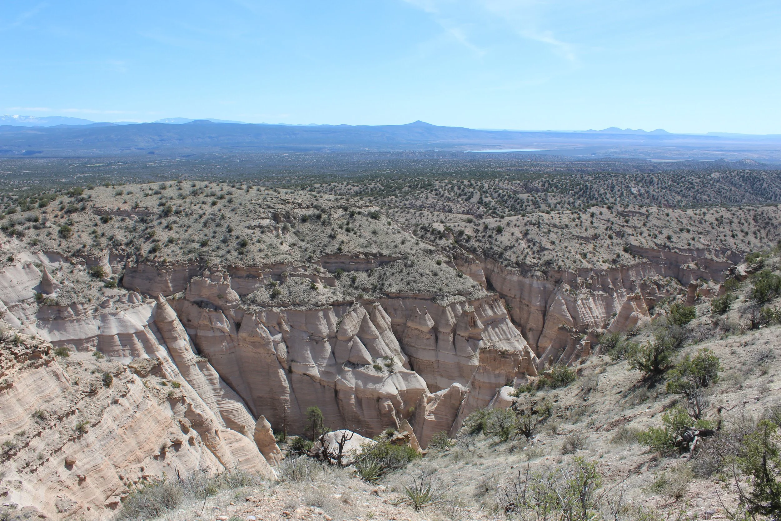
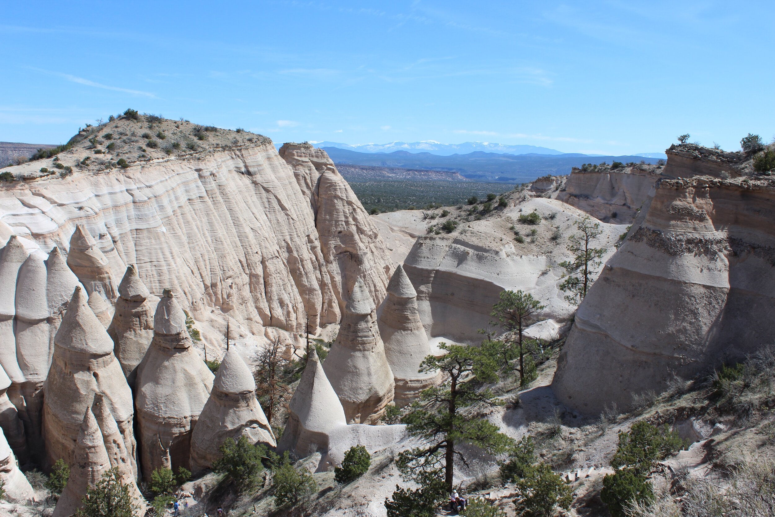
As we emerged from the slot canyon, we were surrounded by more of the cone-shaped “tent rocks”, which are also called hoodoos. These tall and massive formations, made of igneous rock, are believed to be the result of a prehistoric volcanic eruption. Now if my earth science teacher would have brought me here, I would have been more likely to remember that igneous rock is rock that is formed through the cooling and solidification of magma or lava instead of having to research it all these years later! But knowing that still didn’t help explain the reasoning for their unique cone-shape. The volcanic eruptions which happened 6 to 7 million years ago left layers and layers of fairly flat pumice, ash and tuff deposit over 1,000 feet thick. So that still doesn’t explain what caused the cone-shapes, but does explain the beautifully banded-colored rocks with each stripe likely representing another layer of volcanic remnants.
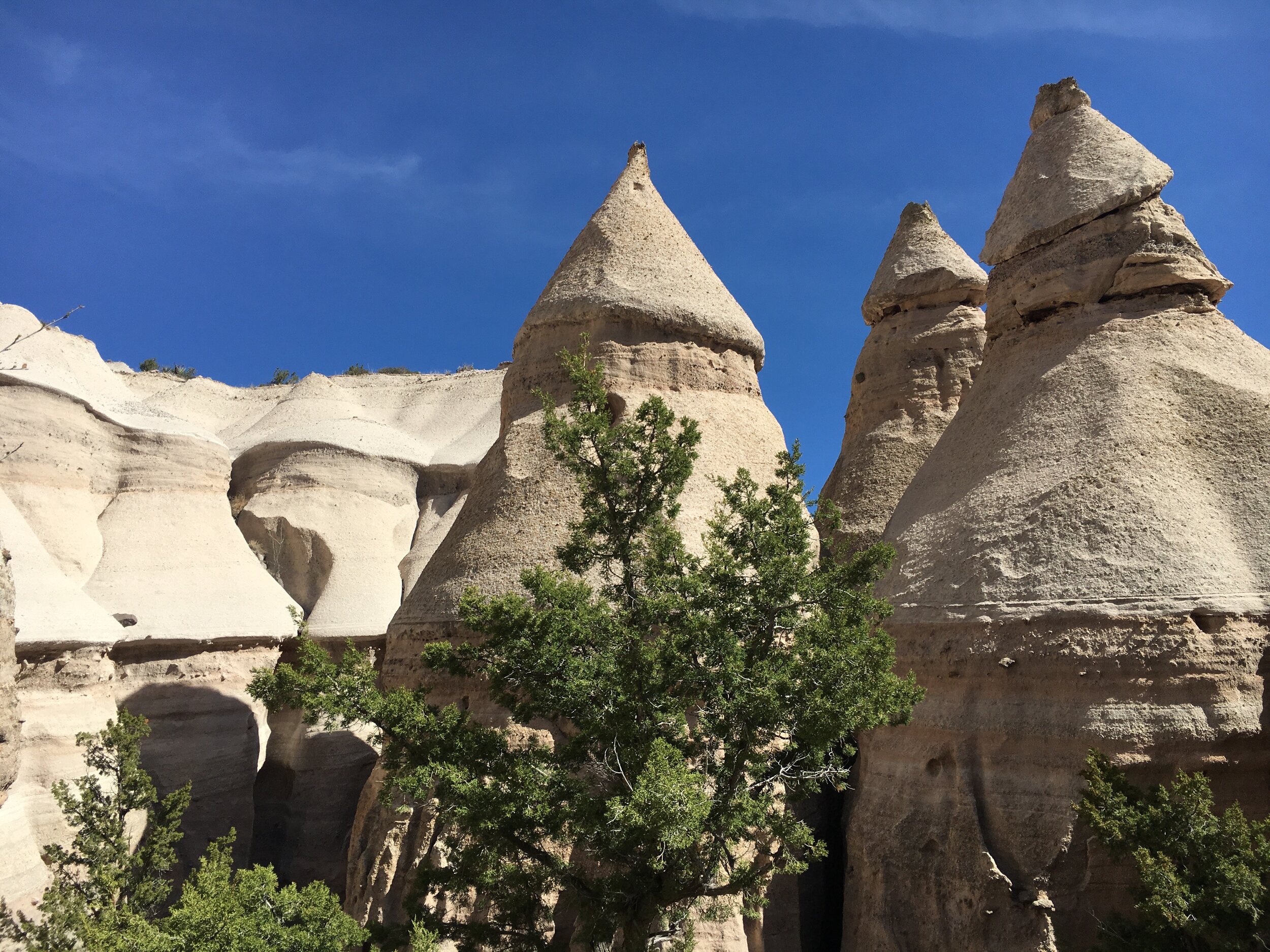
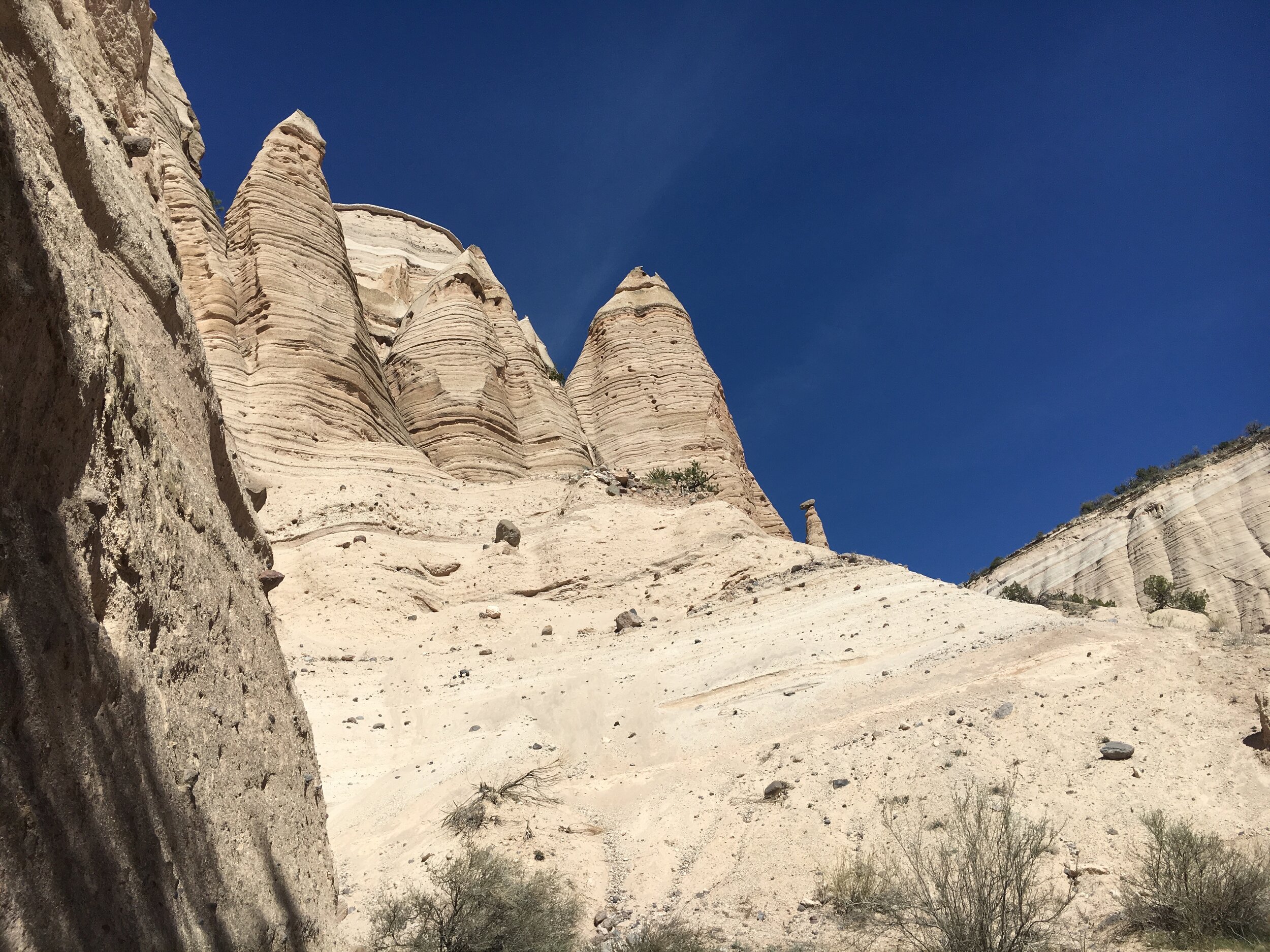
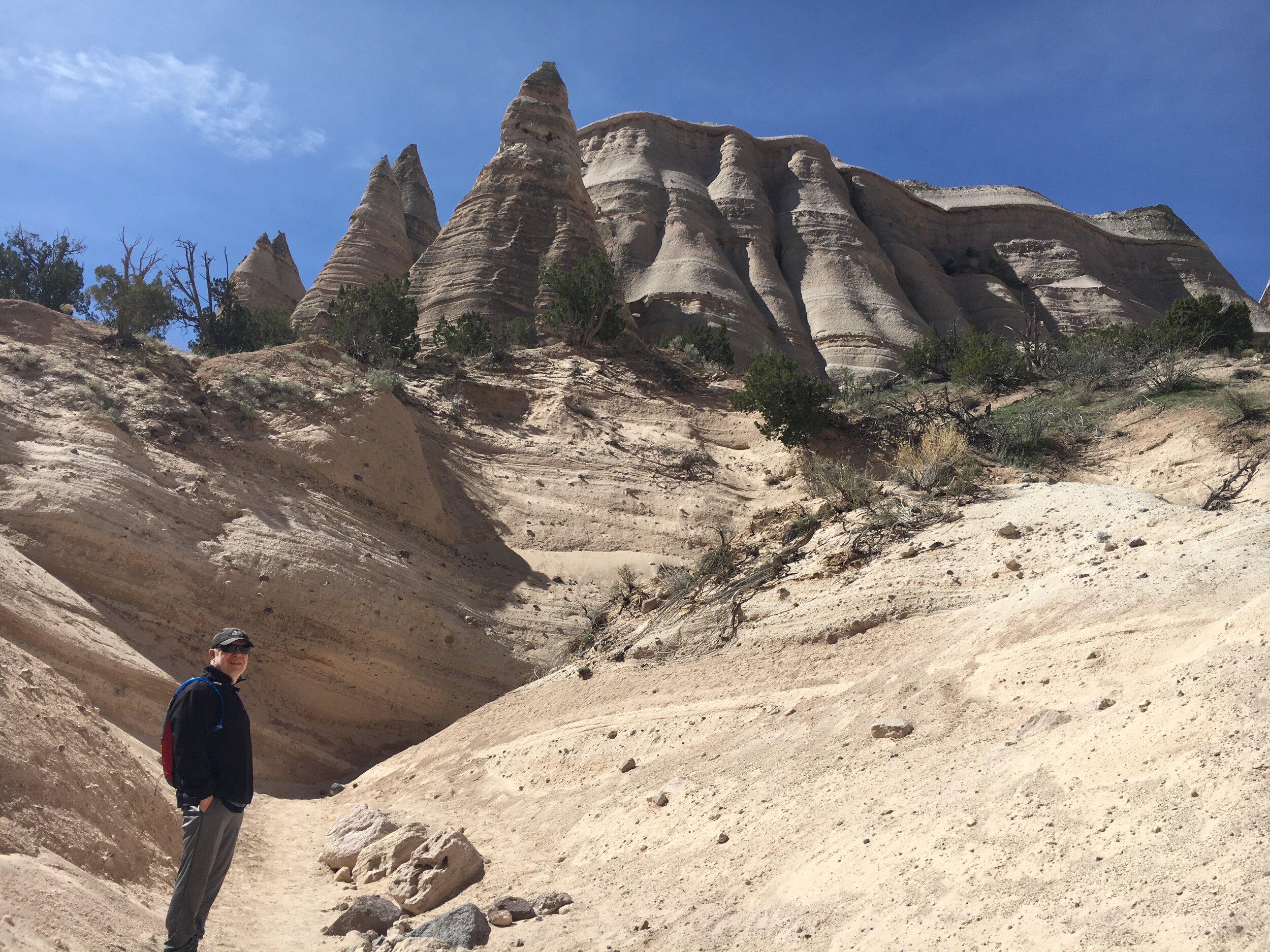
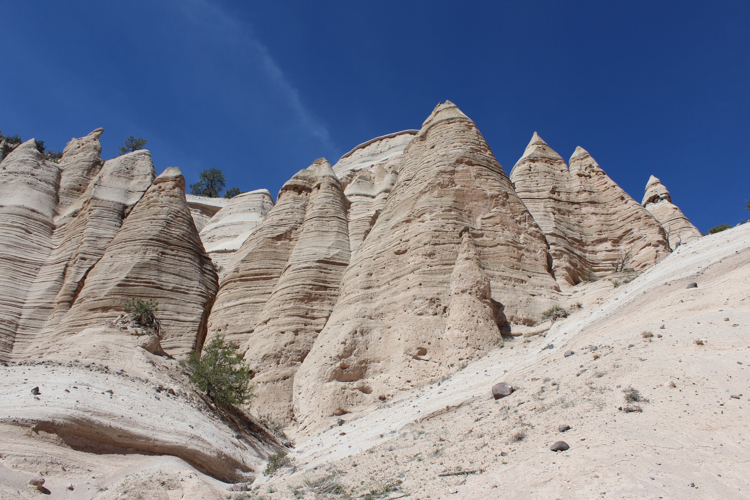
Back to the mystery of the shape of the tent rocks . . . weathering. These relatively softer rocks were easily worn away by wind and water erosion. By water freezing and thawing many, many times over millions of years, cracks form and the hoodoos began to take shape. In addition to the artist of water, wind does its job as well when carrying sand and pebbles to essentially “sandblast” the softer rock away. Many of the tapered tent rocks have a boulder (not soft rock) precariously perched on the top which serves to protect what is below it. The tent rocks who have lost their caprock have worn down more quickly and will eventually disappear to nothing at all. The formations are fairly uniform in shape, but their heights vary from a few feet to 90 feet.
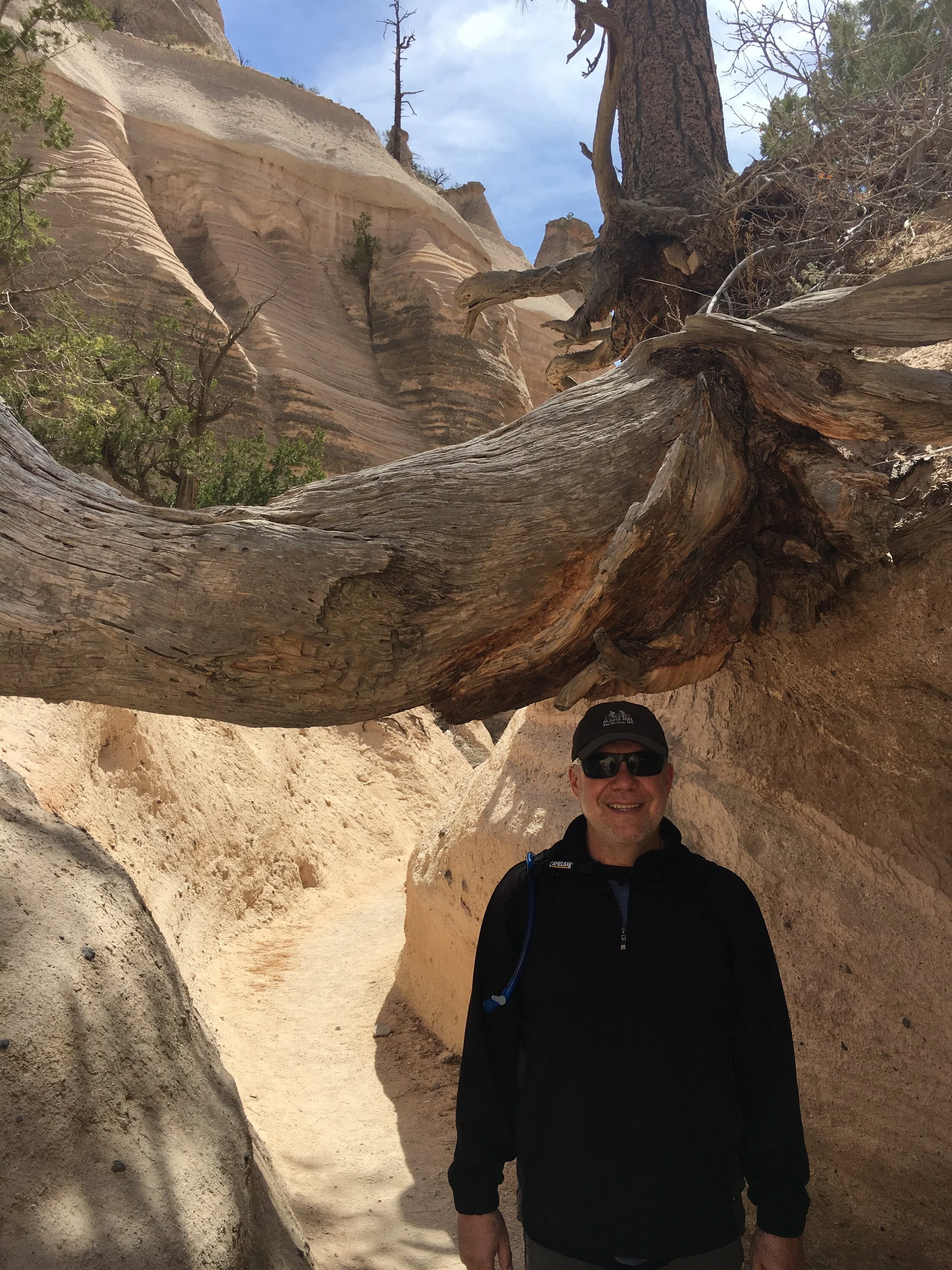
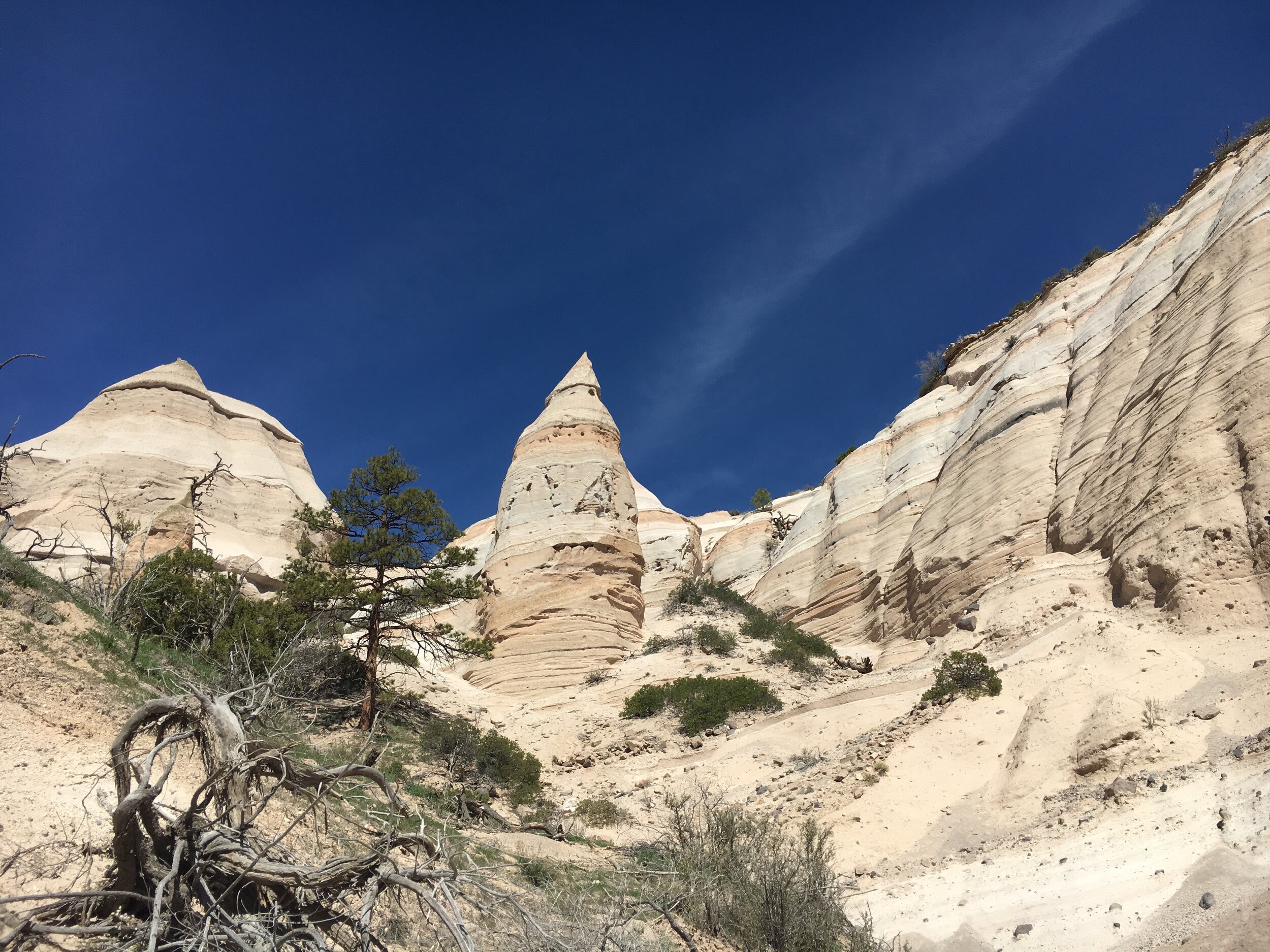
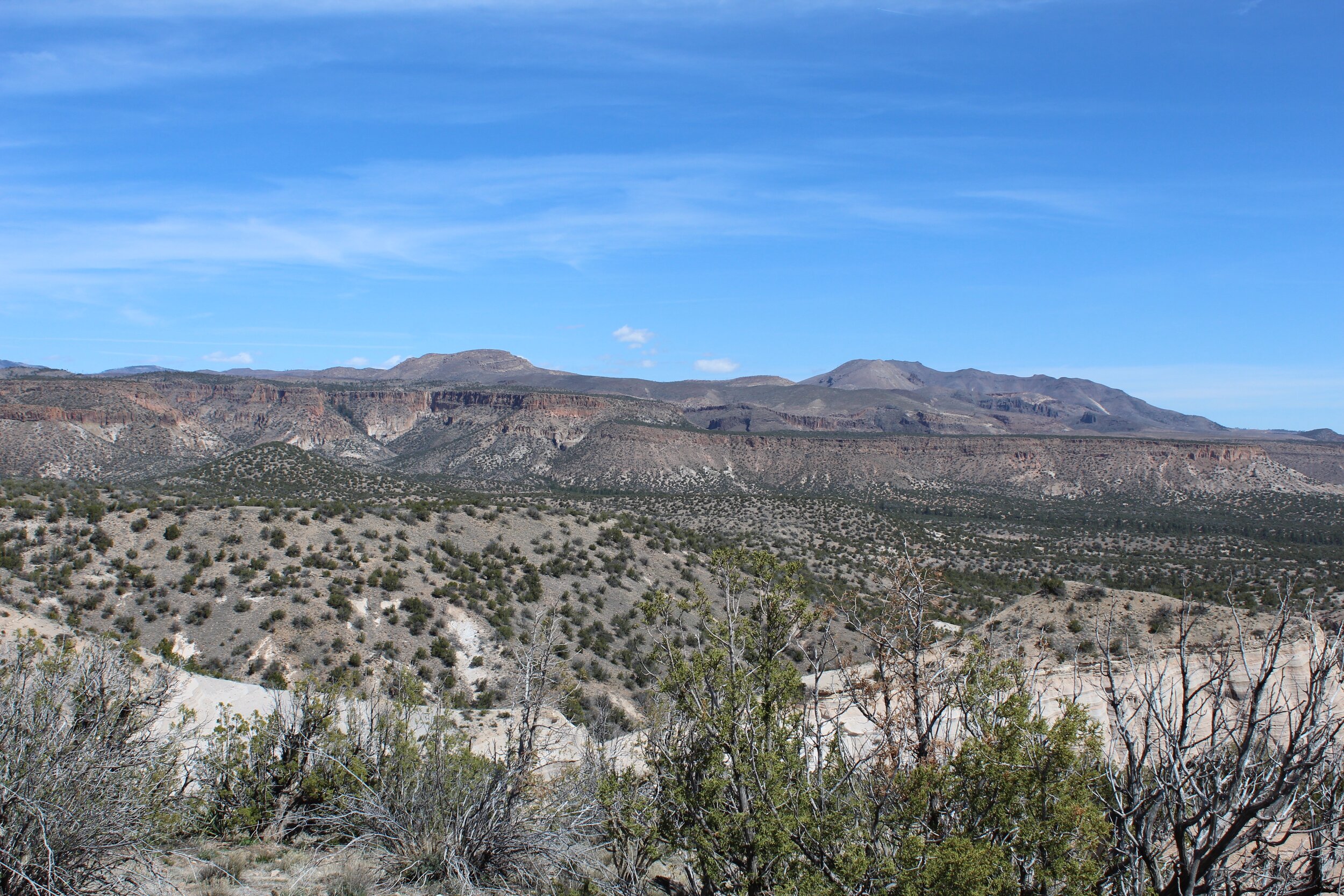
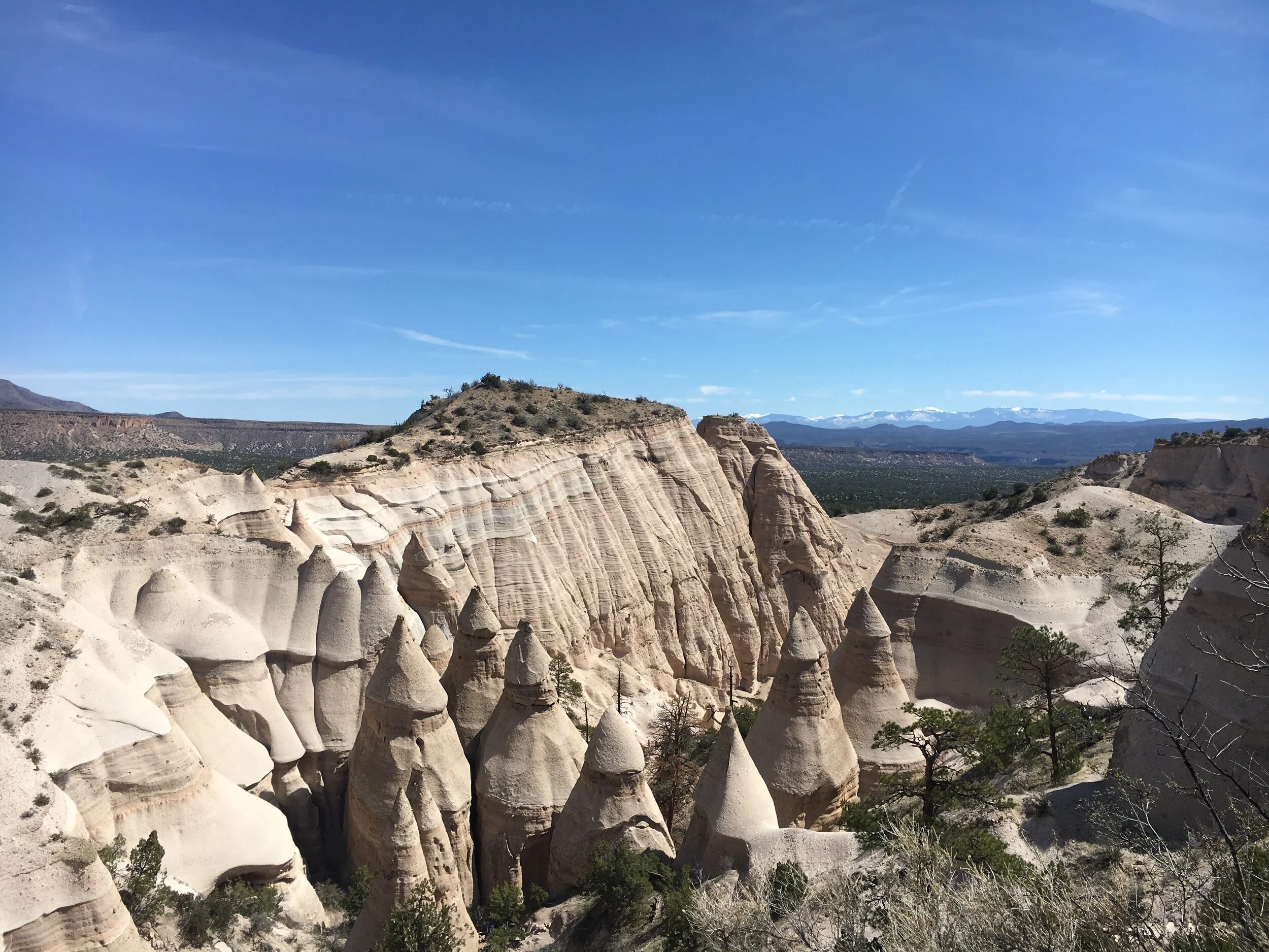
The climb became steeper for a short while as we traveled up the mountainside to reach the mesa, which was dotted with juniper trees. From the top we were able to take one of a variety of short trails to enjoy the panoramic views of all the formations, down into the Peralta Canyon and across the Sangre de Cristo and Jemez Mountains, even some still snow-capped peaks.
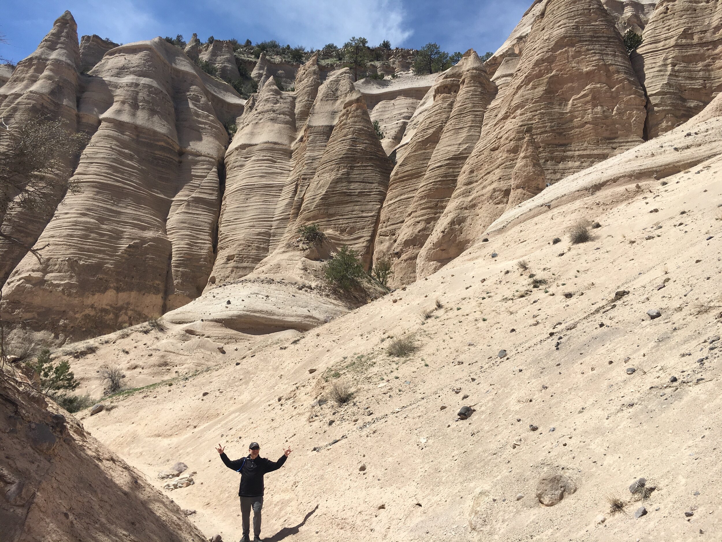
We scrambled down the same trail we ascended and had a whole different perspective of the rock formations. When we reached the intersection of the Slot Canyon trail and the Cave Loop trail, we opted to finish up the rest of the loop rather than heading straight back to the parking lot. It gave us about another mile to appreciate the unique phenomenon of geology present at Kasha-Katuwe Tent Rocks National Monument.
When we arrived back at the parking area, we used the facilites, topped off our water bottles and snagged a shady picnic table where we enjoyed the packed lunch we brought along. We finished up lunch while looking over the map provided to us at the ranger station. There was another loop trail and scenic overlook at the other end of the park, if you continued down a gravel road with warnings for seasonal poor road conditions with low-clearance vehicles and RVs not suggested. While the weather was favorable and being behind the wheel of our trusty SUV would have made this drive easy our eyes were set on our second adventure of the day — a visit to the nearby (sort of) hot springs.
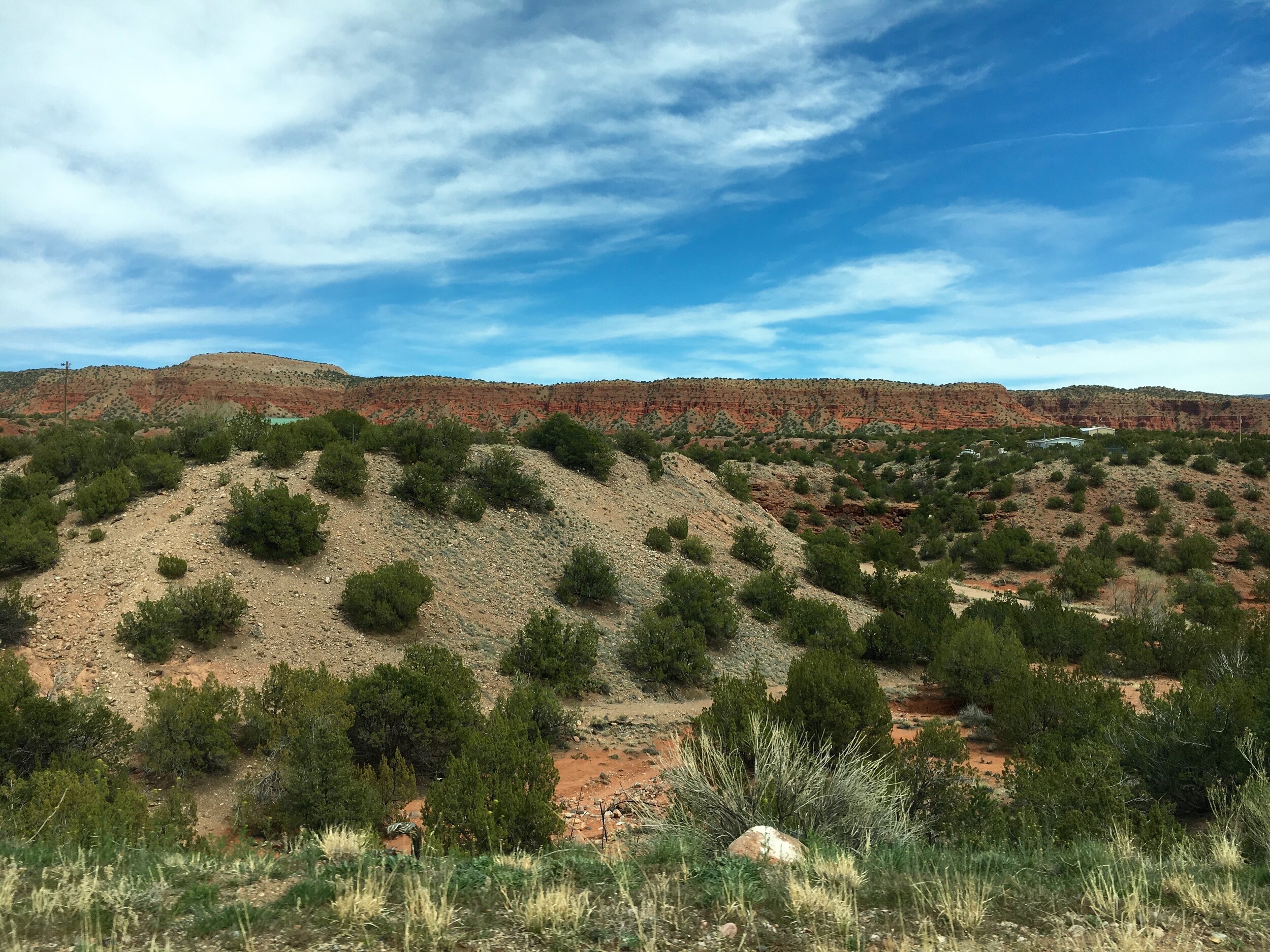
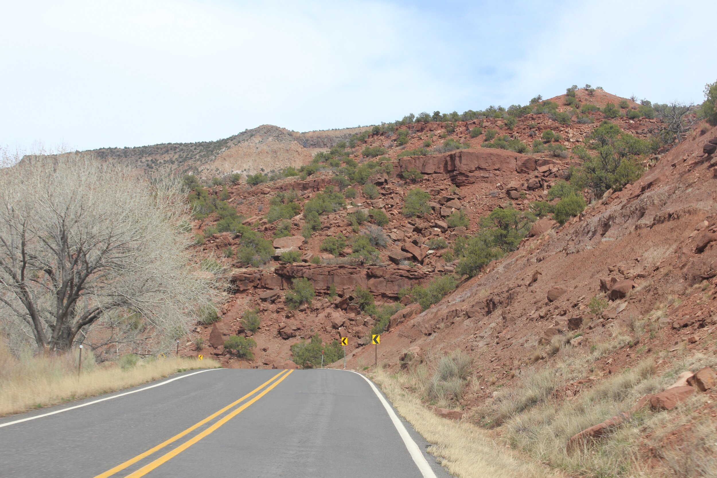
Resting at the bottom of the San Diego Canyon is the quaint village of Jemez Springs just about an hour North of Albuquerque. The drive from Kasha-Katuwe Tent Rocks National Monument to the springs took us through the high dessert with red rock cliffs cropping up on both sides.
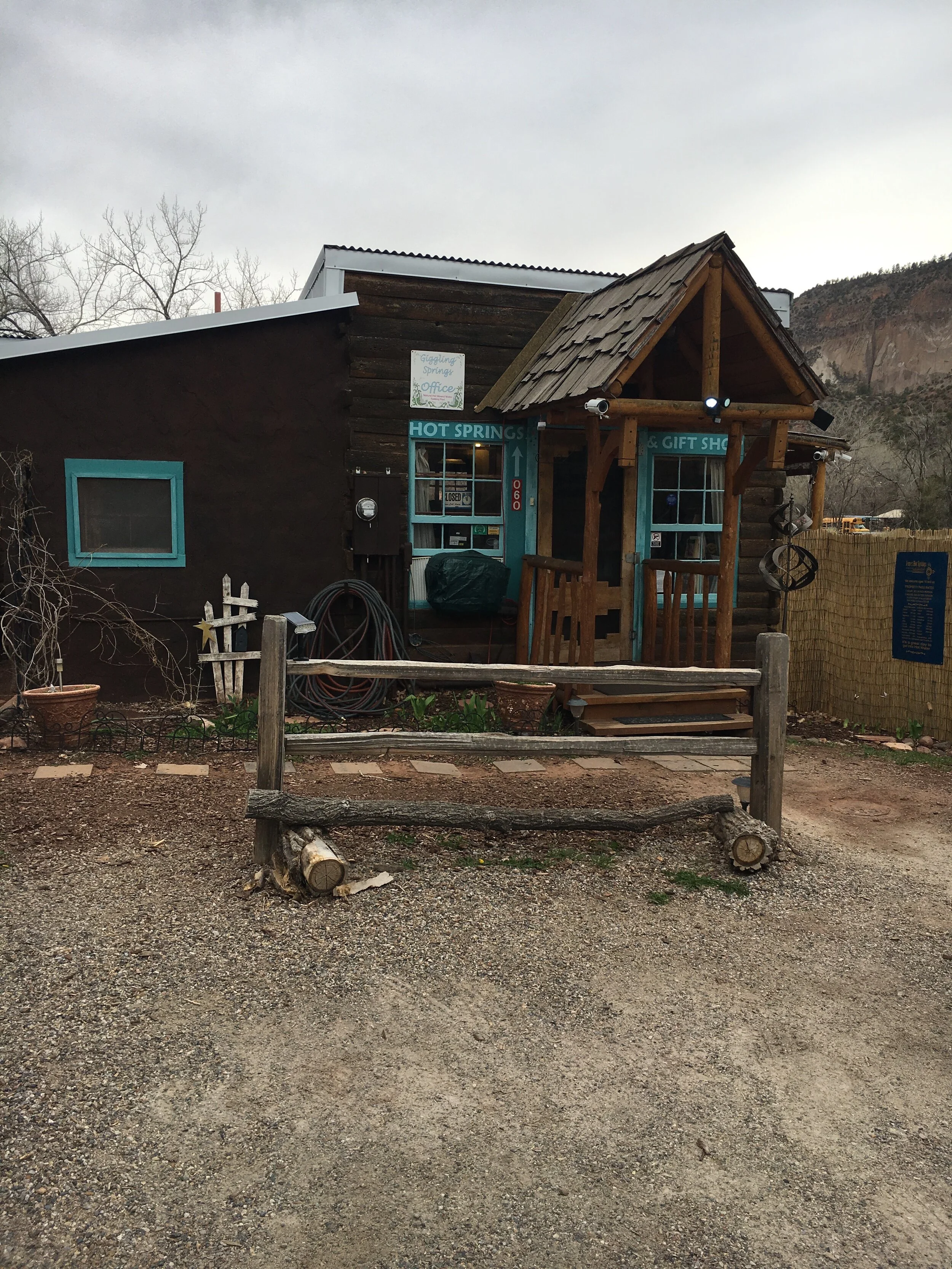
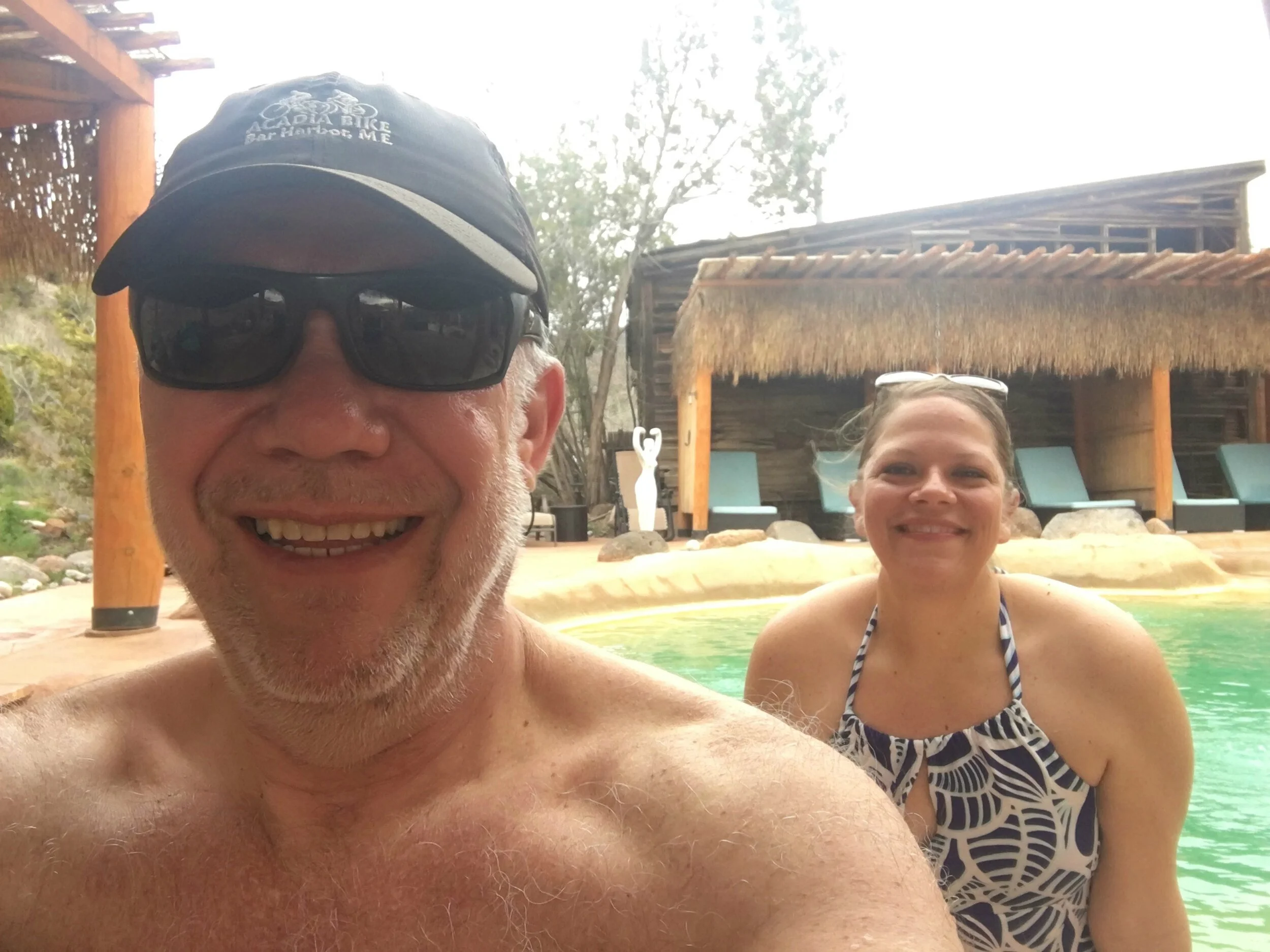
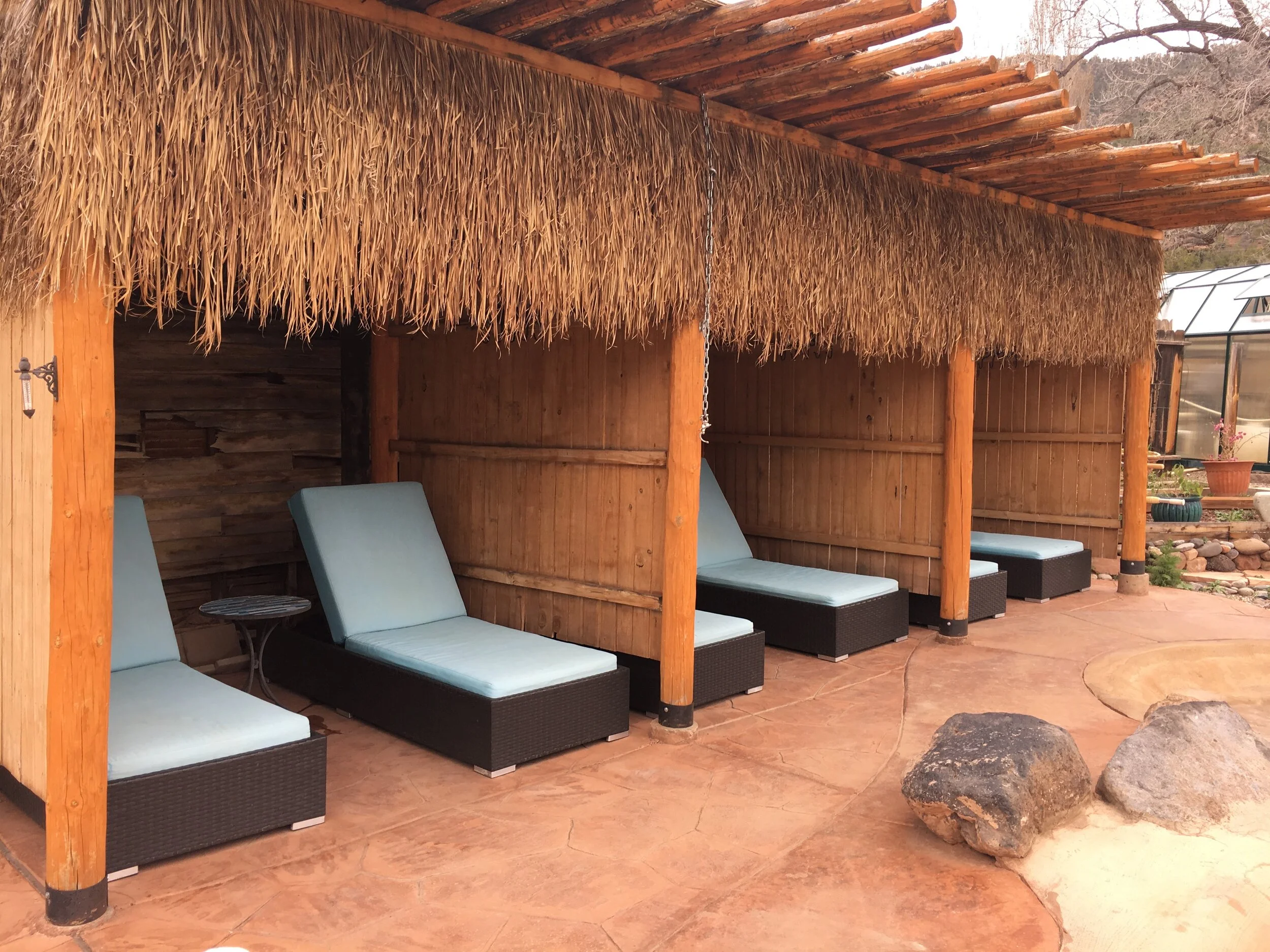
We passed through the Zia and Jemez pueblos, before arriving in Jemez Springs which is aptly named for its abundance of natural hot springs. While several primitive hot springs exist, we opted for the developed hot springs this time around at Jemez Hot Springs, formerly known as “Giggling Springs.” When arriving, we weren’t wowed by any impressive curb appeal or a fancy sign or storefront, but that only added to the charm of the location. We were warmly greeted once we stepped inside the welcome area where we were given information on the options for our “soak” and offered water, tea or coffee. Yes please!
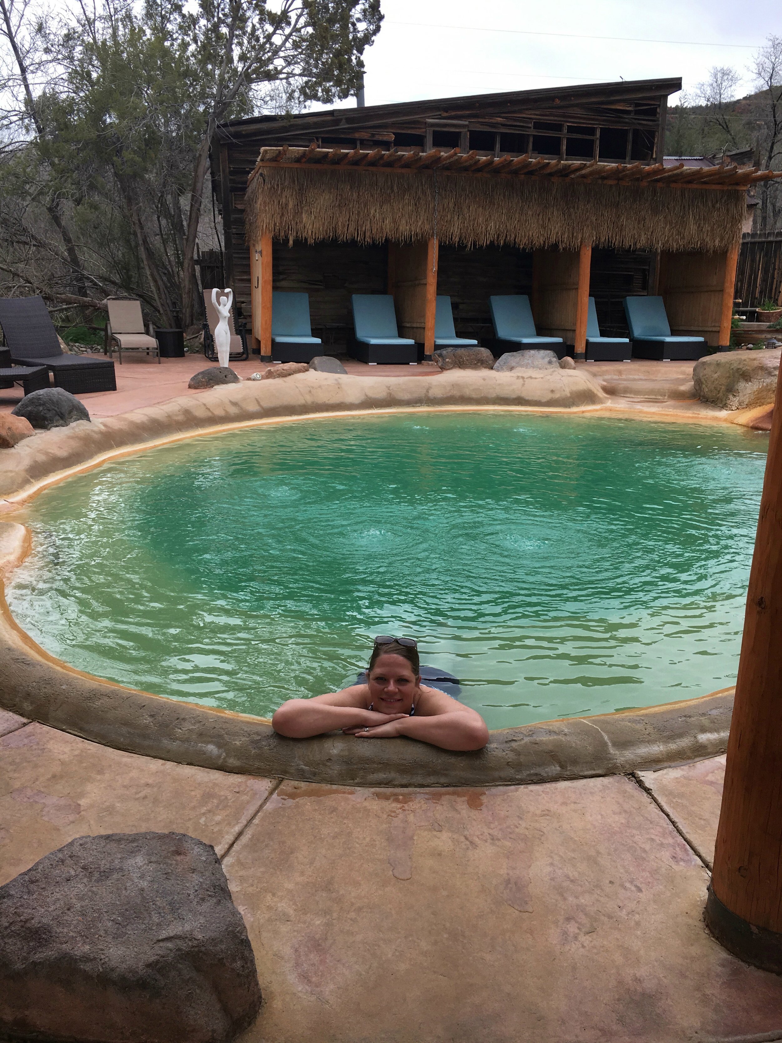
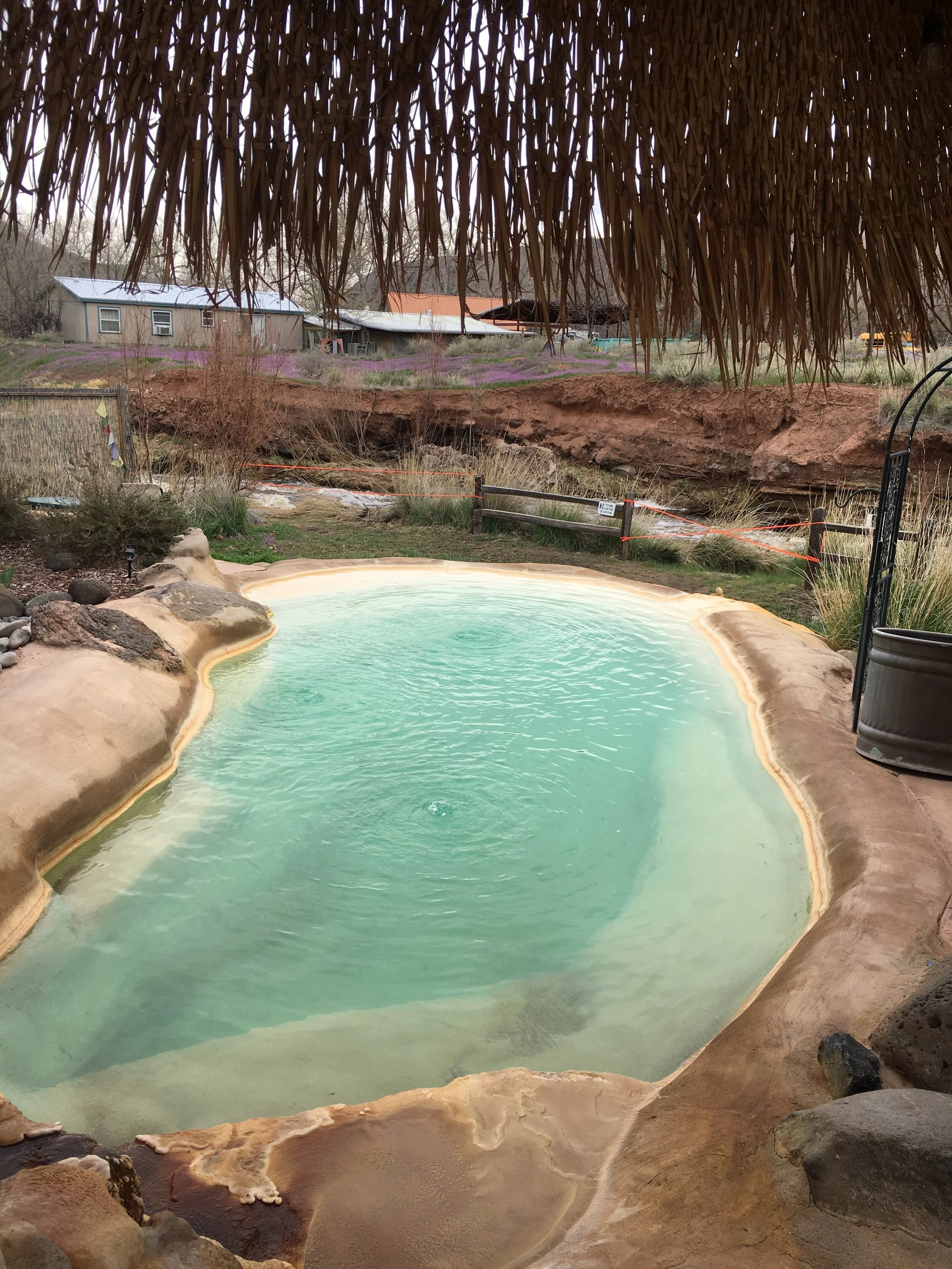
After some basic instructions and information on each of the four outdoor pools, we were guided to a changing area to get our swimmies on. Stepping out onto the grounds petitioned us to take a nice, long, deep & relaxing breath. The area just diffused serenity. Each of the four pools contain the therapeutic mineral water and are each at varying temperatures, ranging from 98 to 105 degrees Fahrenheit.
The Jemez Hot Springs are located right along the banks of the Jemez River and we were serenaded by its raging waters. The bubbling waters of the Jemez River is what gave this spring the original “Giggling Springs” name. As northern New Mexico was recovering from the winter season, the Jemez River’s current was swift as the melting mountain snow was traveling down the riverbed. Along with the river scene, views of the Virgin Mesa were to the west and views of the Cat Mesa were to the east. Check out this photo from the Jemez Hot Springs FB Page showing the Jemez River which wraps around the property.
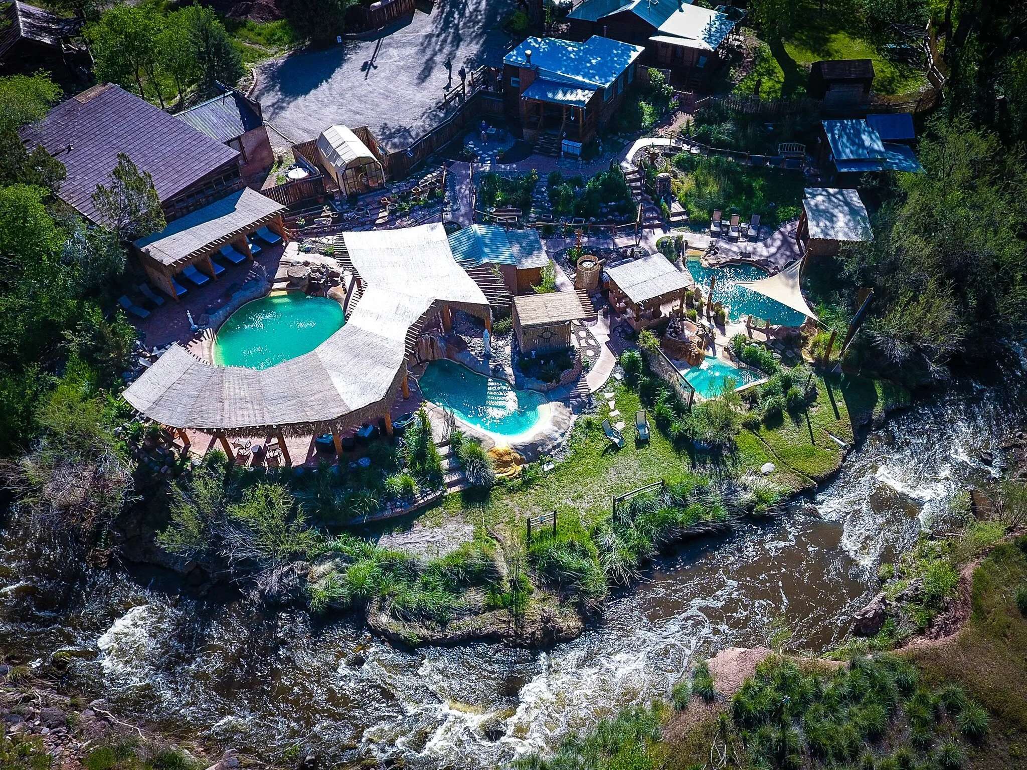
PHOTO CREDIT: Jemez Hot Springs Facebook Page.
The hot springs in the area derive from the super volcano, Valles Caldera about 20 miles north of Jemez Springs. It is one of only six super volcanoes (Yellowstone is another one) in the world developed over a million years ago with its last eruption being about 50,000 years prior. A caldera is a crater or depression that is created after a volcano which expels the majority of its magma in an explosive eruption then collapses to form this basin. I like to think of it as an inverted volcano which spewed all its lava so therefore collapsed. Very scientific thinking, huh? The caldera is responsible for naturally heating the waters that flow to the hot springs in the area. The sea water that has been trapped for eons is why it is so mineral-rich, including at least 17 different minerals.
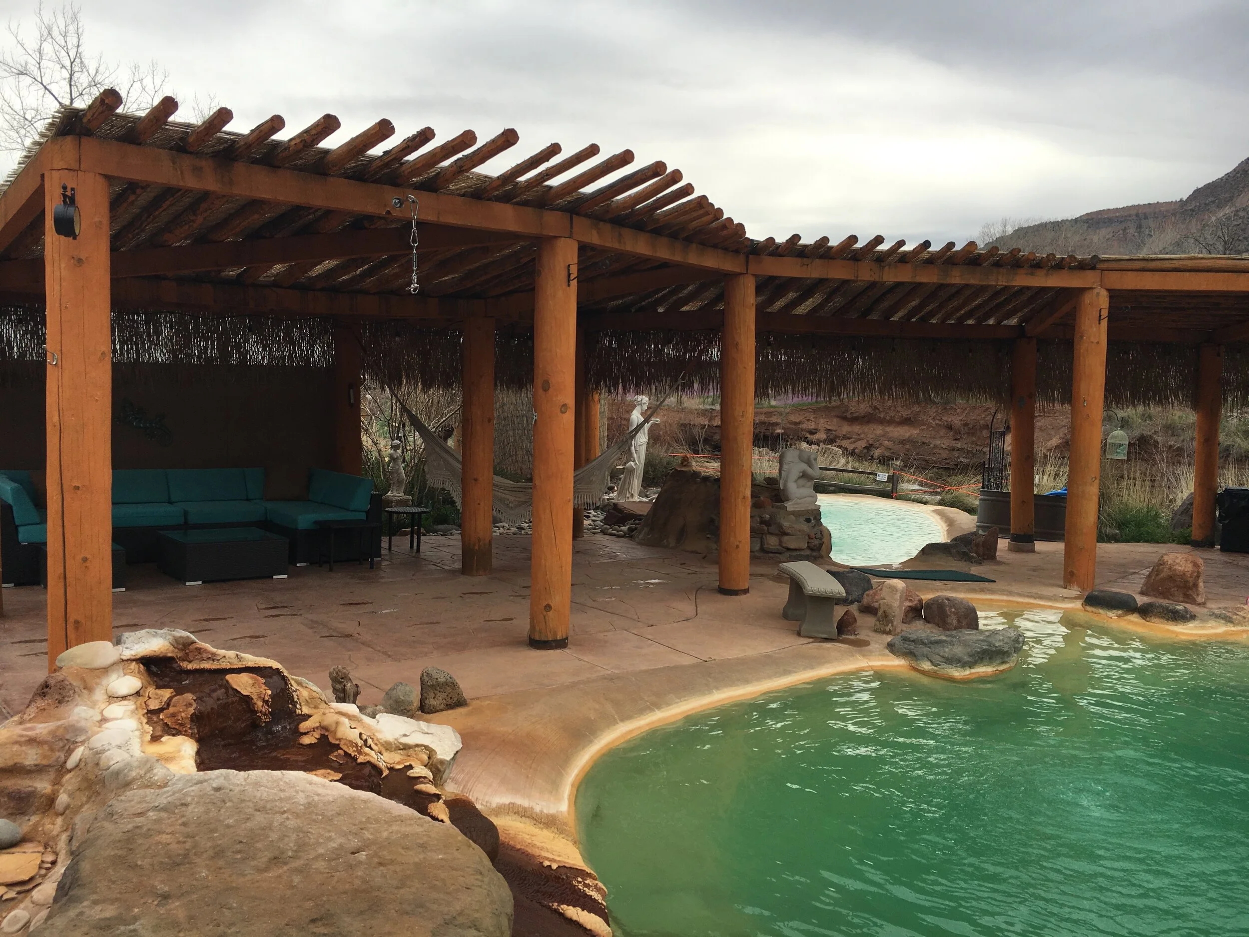
As we moseyed from one pool to the other, finding the one whose temperature we enjoyed most, we enjoyed the contrast of the cool mountain air and the warmth of the springs. Obviously, one of the main differences between a “wild” or natural hot spring, and a “developed” hot spring, is the regulation of how much of the geothermally heated water enters each pool. Whether the minerals did all the things they are known to do, such as increase circulation and pull toxins out of the body through the skin, or not, I do know they had a relaxing effect on our muscles, nerves and mind. I do have to say, despite hiking the day before, we woke the next morning without any muscle pains or cracking joints. So, I’d consider that a success!

The story goes that in 1860 a geyser erupted from the site where the Jemez Springs Bath House now stands and the locals enclosed that spot with a rock wall and reaped the benefits of the mineral-rich water heated by the Earth’s interior. I guess this means sometimes having a weak spot is a good thing, allowing a geyser of goodness into your life. Consider that your daily dose of motivation!
New Mexico is home to 77 natural hot springs and we were happy to enjoy the one that is closest and most accessible to Albuquerque. The Jemez Hot Springs has a New Age atmosphere and the terra-cotta colored pools blend in almost seamlessly with the red-rock mountain backdrop. Maybe next time we will be brave enough to seek out a natural hot springs location, but just in case we will keep this one on speed dial in our GPS, as this place was all good vibes and positive feelings, so it would be hard to not enjoy a soak there.
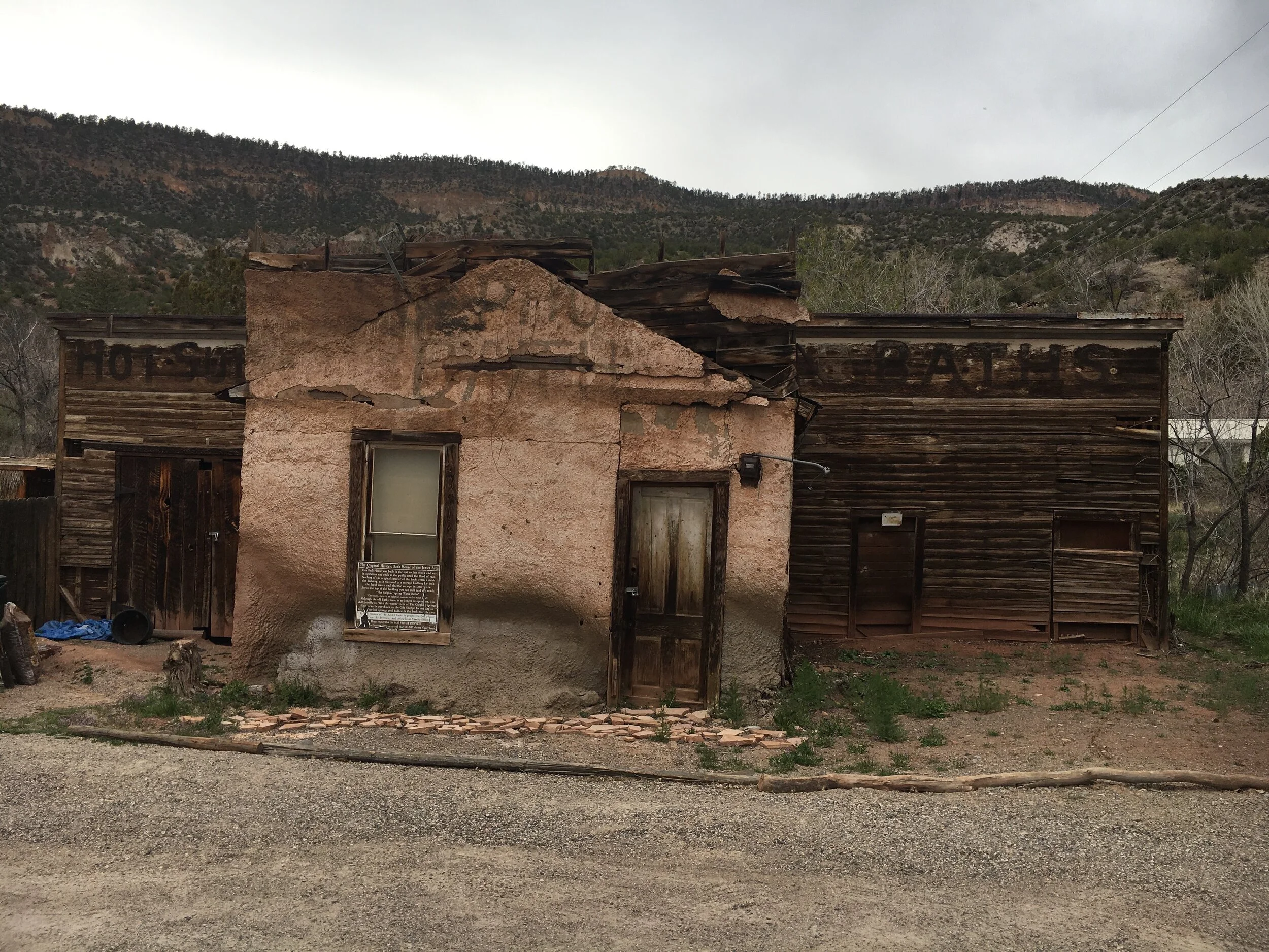
This blink or you’ll miss it town seduces its visitors by its strong culture, picturesque scenery and serving up healing waters since the 1800s. When we first pulled into the parking area, we noticed an old building with the weather-worn words “Hot Sulphur Spring Water Baths” which is the original bath house of the area from the mid 1800s. People started coming from Albuquerque and Sante Fe to enjoy the healing waters and would stay awhile. Assuming that meant for a few hours like we did, but with transportation being a little more time-consuming, it is said guests would stay upwards of a month at a time. The fact that the building dons the word “sulphur” is a bit baffling as there is currently not sulfur in the natural hot springs water in this area. While it is possible that the water did contain sulfur back then, that is not currently the case. We certainly didn’t miss that rotten egg smell that hydrogen sulfide brings to the table at many hot springs locations across the country.
While the round trip from Albuquerque to Tent Rocks to Jemez Springs to Albuquerque was nearly four hours, I wouldn’t hesitate to combine the two again as it was a great duo of exploration and relaxation. Lace up your hiking shoes, but don’t forget to pack your swimsuit!